|
search place name
|
||
Saint-Aignan (Midi-Pyrénées, France)Saint-Aignan is a town in the Midi-Pyrénées region of France. An overview map of the region around Saint-Aignan is displayed below.
regional and 3d topo map of Saint-Aignan, France ::

Saint-Aignan airports ::
The nearest airport is AGF - Agen La Garenne, located 43.2 km north west of Saint-Aignan.
Other airports nearby include TLS - Toulouse Blagnac (48.6 km south east), LRH - La Rochelle Lherm (64.7 km south), LBI - Albi Le Sequestre (83.4 km east), EGC - Bergerac Roumaniere (100.5 km north west), Nearby towns ::
Castelsarrasin (2.3km north east) //
Garganvillar (3.7km south) //
Castelmayran (3.2km north west) //
Angeville (4.4km south west) //
Saint-Nicolas-de-la-Grave (6.8km north west) //
Villa San Gaudenzio (6.8km south east) //
Lafitte (6.8km south east) //
Labourgade (7.9km south) //
Montain (7.9km south) //
Fajolles (7.7km south west) //
[all distances 'as the bird flies' and approximate] 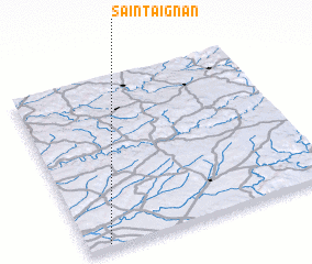 Places with similar names to Saint-Aignan, France ::
// Centegnan (IT)
// Sandégnan (ML)
// Saint-Connan (FR)
// Saint-Ignan (FR)
// Saint-Aignan (FR)
// Saint-Aignan (FR)
// Saint-Aignan (FR)
// Saint-Aignan (FR)
// Saint-Aignan (FR)
// Saint-Agnan (FR)
Disclaimer :: Information on this page comes without warranty of any kind |
||
|
Where is Saint-Aignan? Elevation and coordinates ::
Latitude (lat): 44°1'0"N Longitude (lon): 1°5'0"E
Elevation (approx.): 74m (map arrows pan, magnifying glasses zoom) |
||
|
Visiting Saint-Aignan? Hotel/Accommodation ::
Book a hotel in Saint-Aignan Travel Guide ::
Buy a travel guide for France rental cars ::
car rental offers GPS waypoint ::
download a GPX waypoint (PoI) of Saint-Aignan for your GPS receiver
|
||