|
search place name
|
||
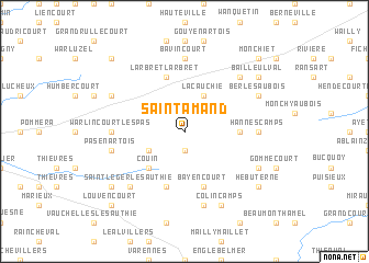
Saint-Amand (Nord-Pas-de-Calais, France)Saint-Amand is a town in the Nord-Pas-de-Calais region of France. An overview map of the region around Saint-Amand is displayed below.
regional and 3d topo map of Saint-Amand, France ::
Saint-Amand airports ::
The nearest airport is LIL - Lille Lesquin, located 57.6 km north east of Saint-Amand.
Other airports nearby include LTQ - Le Tourquet Le Touquet Paris Plage (77.8 km north west), QKT - Kortrijk-vevelgem Wevelgem (85.4 km north east), BVA - Beauvais Tille (85.7 km south west), CQF - Calais Dunkerque (98.5 km north west), Nearby towns ::
Souastre (1.9km south) //
Humbercamps (2.2km north east) //
Pommier (3.0km north east) //
La Cauchie (3.9km north) //
Gaudiempré (3.0km north west) //
Hénu (3.0km south west) //
Couin (4.4km south west) //
Bienvillers-au-Bois (3.6km east) //
Bayencourt (5.7km south) //
Sailly-au-Bois (5.7km south) //
Larbret LʼArbret (5.7km north) //
La Herlière (5.7km north) //
Coigneux (5.7km south) //
Bavincourt (7.4km north) //
Hannescamps (4.7km east) //
Warlincourt-lès-Pas (4.7km west) //
Grincourt-lès-Pas (4.7km west) //
Courcelles-au-Bois (7.5km south) //
Pas-en-Artois (5.1km west) //
Saint-Léger-lès-Authie (6.6km south west) //
Bailleulmont (6.6km north east) //
Berles-au-Bois (6.0km north east) //
Foncquevillers (6.0km south east) //
Colincamps (7.8km south) //
Couturelle (6.0km north west) //
Bailleulval (7.3km north east) //
Hébuterne (7.3km south east) //
Authie (7.3km south west) //
Monchiet (8.8km north east) //
[all distances 'as the bird flies' and approximate] 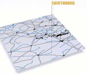 Places with similar names to Saint-Amand, France ::
// Saint Amant (US)
// Saint-Amant (FR)
// Saint-Mandé (FR)
// Saint-Mont (FR)
// SantʼImento (IT)
// Saint-Amand (FR)
// Saint-Amand (FR)
// Sandmount (AU)
// Sandymount (IE)
// Sandymount (IE)
Disclaimer :: Information on this page comes without warranty of any kind |
||
|
Where is Saint-Amand? Elevation and coordinates ::
Latitude (lat): 50°10'0"N Longitude (lon): 2°34'0"E
Elevation (approx.): 149m (map arrows pan, magnifying glasses zoom) |
||
|
Visiting Saint-Amand? Hotel/Accommodation ::
Book a hotel in Saint-Amand Travel Guide ::
Buy a travel guide for France rental cars ::
car rental offers GPS waypoint ::
download a GPX waypoint (PoI) of Saint-Amand for your GPS receiver
|
||