|
search place name
|
||
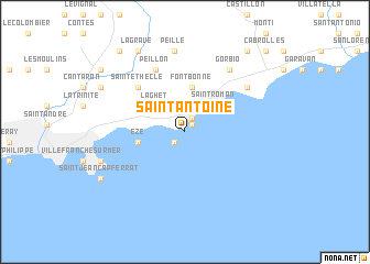
Saint-Antoine (Provence-Alpes-Côte dʼAzur, France)Saint-Antoine is a town in the Provence-Alpes-Côte dʼAzur region of France. An overview map of the region around Saint-Antoine is displayed below.
regional and 3d topo map of Saint-Antoine, France ::
Saint-Antoine airports ::
The nearest airport is NCE - Nice Cote D Azur, located 17.4 km south west of Saint-Antoine.
Other airports nearby include CEQ - Cannes Mandelieu (42.1 km south west), ALL - Albenga (68.0 km north east), CUF - Levaldigi (92.8 km north), TLN - Hyeres Le Palyvestre (123.9 km south west), Nearby towns ::
La Condamine (1.0km north east) //
Monaco (1.0km north east) //
Monte-Carlo (1.0km north east) //
Fontvieille (1.0km north east) //
Moneghetti (1.3km north) //
Cap-dʼAil (1.3km south west) //
Les Moneghetti (1.5km north) //
La Turbie (2.7km north) //
Faussignana (2.8km north east) //
Beausoleil (3.2km north east) //
Laghet (3.4km north west) //
Saint-Roman (3.5km north east) //
Fontbonne (4.5km north) //
Éze (3.6km west) //
Sainte-Thècle (5.7km north west) //
Peillon (6.7km north) //
Gorbio (7.1km north east) //
Roquebrune-Cap-Martin (6.4km north east) //
Peille (8.2km north) //
Beaulieu-sur-Mer (6.8km south west) //
Blausasc (8.9km north west) //
La Grave (8.9km north west) //
Borghéas (7.6km north west) //
Saint-Jean-Cap-Ferrat (7.8km south west) //
Sainte-Agnès (9.4km north east) //
Castel (9.5km north west) //
La Pointe-de-Contes (8.8km north west) //
Cabrolles (10.1km north east) //
[all distances 'as the bird flies' and approximate]  Places with similar names to Saint-Antoine, France ::
// Santo Antonio (BR)
// Santo Antonio (BR)
// Santo Antonio (BR)
// Santo Antonio (BR)
// Santo Antonio (BR)
// Santo Antonio (BR)
// Santo Antônio (BR)
// Santo Antônio (BR)
// Santo Antônio (BR)
// Santo Antônio (BR)
Disclaimer :: Information on this page comes without warranty of any kind |
||
|
Where is Saint-Antoine? Elevation and coordinates ::
Latitude (lat): 43°43'35"N Longitude (lon): 7°24'35"E
Elevation (approx.): 47m (map arrows pan, magnifying glasses zoom) |
||
|
Visiting Saint-Antoine? Hotel/Accommodation ::
Book a hotel in Saint-Antoine Travel Guide ::
Buy a travel guide for France rental cars ::
car rental offers GPS waypoint ::
download a GPX waypoint (PoI) of Saint-Antoine for your GPS receiver
|
||