|
search place name
|
||
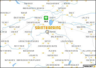
Saint-Baraing (Franche-Comté, France)Saint-Baraing is a town in the Franche-Comté region of France. An overview map of the region around Saint-Baraing is displayed below.
regional and 3d topo map of Saint-Baraing, France ::
Saint-Baraing airports ::
The nearest airport is DLE - Dole Tavaux, located 6.2 km north of Saint-Baraing.
Other airports nearby include DIJ - Dijon Longvic (41.1 km north west), XCD - Chalon Champforgeuil (50.1 km west), XBK - Bourg Ceyzeriat (87.7 km south), QNX - Macon Charnay (90.8 km south west), Nearby towns ::
Rahon (1.3km east) //
Chaussin (2.2km south west) //
Gatey (3.7km south) //
Asnans (3.9km south) //
Balaiseaux (3.1km south east) //
Molay (3.9km north) //
Chaînée-des-Coupis (5.6km south) //
Gevry (5.7km north) //
Tavaux (6.1km north west) //
Parcey (5.3km north east) //
Champdivers (5.3km north west) //
Peseux (5.1km west) //
Les Essards-Taignevaux (7.5km south) //
Pleure (7.5km south) //
Longwy-sur-le-Doubs (6.3km south west) //
Le Deschaux (6.3km south east) //
Chêne-Bernard (8.3km south east) //
Beauvoisin (9.0km south west) //
Villette-lès-Dole (9.0km north east) //
[all distances 'as the bird flies' and approximate] 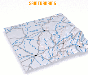 Places with similar names to Saint-Baraing, France ::
Disclaimer :: Information on this page comes without warranty of any kind |
||
|
Where is Saint-Baraing? Elevation and coordinates ::
Latitude (lat): 46°59'0"N Longitude (lon): 5°26'0"E
Elevation (approx.): 195m (map arrows pan, magnifying glasses zoom) |
||
|
Visiting Saint-Baraing? Hotel/Accommodation ::
Book a hotel in Saint-Baraing Travel Guide ::
Buy a travel guide for France rental cars ::
car rental offers GPS waypoint ::
download a GPX waypoint (PoI) of Saint-Baraing for your GPS receiver
|
||