|
search place name
|
||
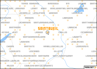
Saint-Bueil (Rhône-Alpes, France)Saint-Bueil is a town in the Rhône-Alpes region of France. An overview map of the region around Saint-Bueil is displayed below.
regional and 3d topo map of Saint-Bueil, France ::
Saint-Bueil airports ::
The nearest airport is CMF - Chambery Aix Les Bains, located 24.5 km north east of Saint-Bueil.
Other airports nearby include GNB - Grenoble Saint Geoirs (30.0 km south west), LYS - Lyon Saint Exupery (54.5 km north west), NCY - Annecy Meythet (60.7 km north east), LYN - Lyon Bron (64.5 km north west), Nearby towns ::
La Montagne-Dessus (1.3km east) //
Saint-Martin-de Vaulserre (2.3km north west) //
La Chapelle (2.3km south west) //
Merlas (2.3km south west) //
Voissant (2.3km north east) //
La Montagne (2.3km south east) //
La Sauge (2.6km west) //
La Montagne-Dessous (2.6km east) //
Saint-Jean-dʼAvelanne (3.9km north) //
Saint-Albin-de-Vaulserre (3.9km north) //
Saint-Béron (4.5km north east) //
Chailles (3.9km east) //
Saint-Franc (4.3km north east) //
Velanne (4.3km north west) //
Miribel-les-Échelles (5.7km south) //
Saint-Geoire-en-Valdaine (4.3km south west) //
Le Pont-de-Beauvoisin (7.5km north) //
Domessin (7.5km north) //
Saint-Pierre-de-Génébroz (5.5km east) //
La Folatière (7.9km north) //
Entre-deux-Guiers (6.4km south east) //
Les Échelles (6.4km south east) //
Villette (7.9km south) //
Saint-Sixte (7.6km south west) //
Pressins (7.6km north west) //
Les Combes (8.4km south west) //
La Bridoire (7.6km north east) //
[all distances 'as the bird flies' and approximate] 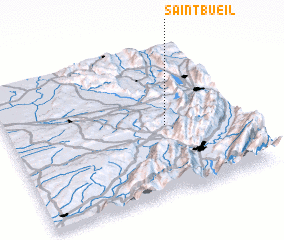 Places with similar names to Saint-Bueil, France ::
// Sandabuli (MM)
// Santaballa (ES)
// Sindhbal (IN)
// Sonnat-e Bālā (IR)
// Sande Baléa (ML)
// Saintable (HT)
// Saint-Boil (FR)
// Zantobli (LR)
// Zondobli (LR)
// Sandbol (SE)
Disclaimer :: Information on this page comes without warranty of any kind |
||
|
Where is Saint-Bueil? Elevation and coordinates ::
Latitude (lat): 45°28'0"N Longitude (lon): 5°41'0"E
Elevation (approx.): 455m (map arrows pan, magnifying glasses zoom) |
||
|
Visiting Saint-Bueil? Hotel/Accommodation ::
Book a hotel in Saint-Bueil Travel Guide ::
Buy a travel guide for France rental cars ::
car rental offers GPS waypoint ::
download a GPX waypoint (PoI) of Saint-Bueil for your GPS receiver
|
||