|
search place name
|
||
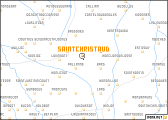
Saint-Christaud (Midi-Pyrénées, France)Saint-Christaud is a town in the Midi-Pyrénées region of France. An overview map of the region around Saint-Christaud is displayed below.
regional and 3d topo map of Saint-Christaud, France ::
Saint-Christaud airports ::
The nearest airport is LDE - Tarbes Lourdes, located 45.2 km south west of Saint-Christaud.
Other airports nearby include PUF - Pau Pyrenees (58.0 km west), AGF - Agen La Garenne (75.9 km north), LRH - La Rochelle Lherm (81.2 km east), TLS - Toulouse Blagnac (89.3 km east), Nearby towns ::
Pallanne (2.3km south west) //
Bars (3.3km south east) //
Pouylebon (3.3km north east) //
Mascaras (3.3km north west) //
Laveraët (4.0km west) //
Bassoues (5.7km north) //
Monlezun (5.5km south west) //
Monclar-sur-Losse (5.4km east) //
Tillac (7.5km south) //
Monpardiac (7.5km south) //
Marseillan (6.9km south east) //
Laas (7.9km south) //
Scieurac-et-Flourès (6.5km north west) //
Montesquiou (7.7km north east) //
Saint-Maur-Soulès (7.7km south east) //
Troncens (8.4km south west) //
Blousson-Sérian (9.2km south west) //
[all distances 'as the bird flies' and approximate] 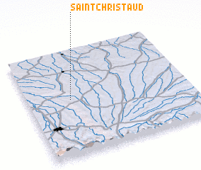 Places with similar names to Saint-Christaud, France ::
// Saint-Christaud (FR)
Disclaimer :: Information on this page comes without warranty of any kind |
||
|
Where is Saint-Christaud? Elevation and coordinates ::
Latitude (lat): 43°32'0"N Longitude (lon): 0°16'0"W
Elevation (approx.): 266m (map arrows pan, magnifying glasses zoom) |
||
|
Visiting Saint-Christaud? Hotel/Accommodation ::
Book a hotel in Saint-Christaud Travel Guide ::
Buy a travel guide for France rental cars ::
car rental offers GPS waypoint ::
download a GPX waypoint (PoI) of Saint-Christaud for your GPS receiver
|
||