|
search place name
|
||
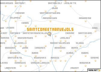
Saint-Côme-et-Maruéjols (Languedoc-Roussillon, France)Saint-Côme-et-Maruéjols is a town in the Languedoc-Roussillon region of France. An overview map of the region around Saint-Côme-et-Maruéjols is displayed below.
regional and 3d topo map of Saint-Côme-et-Maruéjols, France ::
Saint-Côme-et-Maruéjols airports ::
The nearest airport is FNI - Nimes Garons, located 18.6 km east of Saint-Côme-et-Maruéjols.
Other airports nearby include MPL - Montpellier Mediterranee (32.8 km south west), AVN - Avignon Caumont (57.3 km east), OBS - Aubenas-vals-lanas Ardeche Meridionale (82.0 km north), BZR - Beziers Vias (87.6 km south west), Nearby towns ::
Clarensac (1.3km east) //
Maruéjols (1.3km west) //
Saint Dionizy (3.3km south east) //
Calvisson (3.9km south) //
Nages-et-Solorgues (4.6km south east) //
Saint-Étienne-dʼEscalles (4.0km west) //
Parignargues (5.6km north) //
Langlade (4.4km south east) //
Boissières (6.2km south east) //
Congéniès (6.2km south west) //
Montpezat (5.5km north west) //
Saint-Mamert-du-Gard (7.4km north) //
Caveirac (5.3km east) //
Aubais (8.4km south west) //
Uchaud (9.1km south east) //
[all distances 'as the bird flies' and approximate] 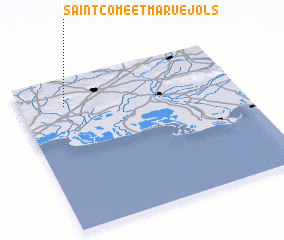 Places with similar names to Saint-Côme-et-Maruéjols, France :: Disclaimer :: Information on this page comes without warranty of any kind |
||
|
Where is Saint-Côme-et-Maruéjols? Elevation and coordinates ::
Latitude (lat): 43°49'0"N Longitude (lon): 4°12'0"E
Elevation (approx.): 51m (map arrows pan, magnifying glasses zoom) |
||
|
Visiting Saint-Côme-et-Maruéjols? Hotel/Accommodation ::
Book a hotel in Saint-Côme-et-Maruéjols Travel Guide ::
Buy a travel guide for France rental cars ::
car rental offers GPS waypoint ::
download a GPX waypoint (PoI) of Saint-Côme-et-Maruéjols for your GPS receiver
|
||