|
search place name
|
||
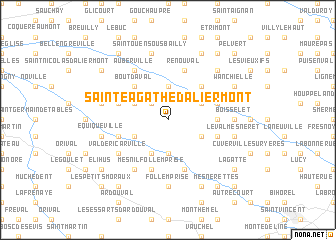
Sainte-Agathe-dʼAliermont (Haute-Normandie, France)Sainte-Agathe-dʼAliermont is a town in the Haute-Normandie region of France. An overview map of the region around Sainte-Agathe-dʼAliermont is displayed below.
regional and 3d topo map of Sainte-Agathe-dʼAliermont, France ::
Sainte-Agathe-dʼAliermont airports ::
The nearest airport is URO - Rouen Vallee De Seine, located 51.0 km south of Sainte-Agathe-dʼAliermont.
Other airports nearby include BVA - Beauvais Tille (71.3 km south east), LTQ - Le Tourquet Le Touquet Paris Plage (79.1 km north), LEH - Le Havre Octeville (94.7 km west), POX - Pontoise Cormeilles En Vexin (97.3 km south east), Nearby towns ::
Bout dʼAmont (2.2km north west) //
Osmoy-Saint-Valery (3.7km south) //
Douvrend (3.7km north) //
Beauval (3.0km south east) //
Le Hamel (3.0km north east) //
Maintru (3.9km south) //
Épinay (3.9km south) //
Ricarville-du-Val (3.0km south west) //
Notre-Dame-dʼAliermont (3.0km north west) //
Mont Landrin (4.4km north east) //
Bout dʼAval (4.4km north west) //
Boissay (3.6km east) //
Renouval (5.7km north) //
Bures-en-Bray (5.7km south) //
Les Halots (4.0km south east) //
Croixdalle (4.0km south east) //
Saint-Vaast-dʼÉquiqueville (4.0km south west) //
Mesnil-Follemprise (5.7km south) //
Wanchy-Capval (4.0km north east) //
Saint-Jacques-dʼAliermont (4.0km north west) //
Val-de-Ricarville (5.2km south west) //
Auberville (6.1km north west) //
Les Bosquets (6.1km south west) //
Follemprise (7.4km south) //
Boisselet (4.8km east) //
Le Valmesneret (5.1km east) //
Équiqueville (5.1km west) //
Saint-Ouen-sous-Bailly (7.5km north) //
Orival (5.1km west) //
[all distances 'as the bird flies' and approximate] 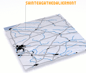 Places with similar names to Sainte-Agathe-dʼAliermont, France :: Disclaimer :: Information on this page comes without warranty of any kind |
||
|
Where is Sainte-Agathe-dʼAliermont? Elevation and coordinates ::
Latitude (lat): 49°50'0"N Longitude (lon): 1°19'0"E
Elevation (approx.): 185m (map arrows pan, magnifying glasses zoom) |
||
|
Visiting Sainte-Agathe-dʼAliermont? Hotel/Accommodation ::
Book a hotel in Sainte-Agathe-dʼAliermont Travel Guide ::
Buy a travel guide for France rental cars ::
car rental offers GPS waypoint ::
download a GPX waypoint (PoI) of Sainte-Agathe-dʼAliermont for your GPS receiver
|
||