|
search place name
|
||
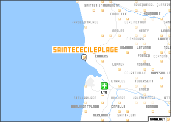
Sainte-Cécile-Plage (Nord-Pas-de-Calais, France)Sainte-Cécile-Plage is a town in the Nord-Pas-de-Calais region of France. An overview map of the region around Sainte-Cécile-Plage is displayed below.
regional and 3d topo map of Sainte-Cécile-Plage, France ::
Sainte-Cécile-Plage airports ::
The nearest airport is LTQ - Le Tourquet Le Touquet Paris Plage, located 6.1 km south east of Sainte-Cécile-Plage.
Other airports nearby include CQF - Calais Dunkerque (51.2 km north east), LYX - Lydd (62.8 km north west), MSE - Manston (87.9 km north), LIL - Lille Lesquin (106.7 km east), Nearby towns ::
Dannes (2.2km north east) //
Camiers (2.4km east) //
Le Touquet-Paris-Plage (5.6km south) //
Le Croquelet (6.0km north east) //
Hardelot-Plage (7.4km north) //
Lefaux (5.1km east) //
Neufchâtel-Hardelot (6.6km north east) //
Trépied (7.8km south) //
Étaples (7.3km south east) //
Nesles (7.3km north east) //
[all distances 'as the bird flies' and approximate] 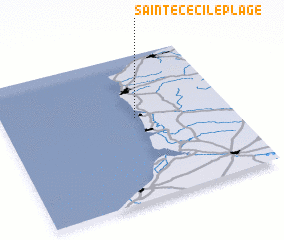 Places with similar names to Sainte-Cécile-Plage, France :: Disclaimer :: Information on this page comes without warranty of any kind |
||
|
Where is Sainte-Cécile-Plage? Elevation and coordinates ::
Latitude (lat): 50°34'0"N Longitude (lon): 1°35'0"E
Elevation (approx.): 11m (map arrows pan, magnifying glasses zoom) |
||
|
Visiting Sainte-Cécile-Plage? Hotel/Accommodation ::
Book a hotel in Sainte-Cécile-Plage Travel Guide ::
Buy a travel guide for France rental cars ::
car rental offers GPS waypoint ::
download a GPX waypoint (PoI) of Sainte-Cécile-Plage for your GPS receiver
|
||