|
search place name
|
||
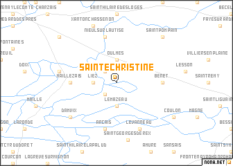
Sainte-Christine (Pays de la Loire, France)Sainte-Christine is a town in the Pays de la Loire region of France. An overview map of the region around Sainte-Christine is displayed below.
regional and 3d topo map of Sainte-Christine, France ::
Sainte-Christine airports ::
The nearest airport is NIT - Niort Souche, located 21.3 km east of Sainte-Christine.
Other airports nearby include RCO - Rochefort St Agnant (58.6 km south west), EDM - La Roche-sur-yon Les Ajoncs (66.1 km north west), PIS - Poitiers Biard (78.7 km east), CET - Cholet Le Pontreau (81.1 km north), Nearby towns ::
Bouillé-Courdault (2.3km north west) //
Saint-Sigismond (2.3km south west) //
Oulmes (3.7km north) //
Liez (2.6km west) //
Le Mazeau (3.7km south) //
Maillezais (5.1km west) //
Benet (5.1km east) //
Nieul-sur-lʼAutise (7.5km north) //
Arçais (7.5km south) //
Le Vanneau (7.8km south) //
Damvix (7.6km south west) //
Saint-Pompain (9.0km north east) //
[all distances 'as the bird flies' and approximate] 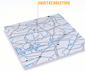 Places with similar names to Sainte-Christine, France ::
// Santa Cristina (IT)
// Santa Cristina (IT)
// Santa Cristina (IT)
// Santa Cristina (IT)
// Santa Cristina (IT)
// Santa Cristina (PT)
// Santa Cristina (PT)
// Santa Cristina (PT)
// Santa Cristina (ES)
// Santa Cristina (ES)
Disclaimer :: Information on this page comes without warranty of any kind |
||
|
Where is Sainte-Christine? Elevation and coordinates ::
Latitude (lat): 46°22'0"N Longitude (lon): 0°40'0"W
Elevation (approx.): 6m (map arrows pan, magnifying glasses zoom) |
||
|
Visiting Sainte-Christine? Hotel/Accommodation ::
Book a hotel in Sainte-Christine Travel Guide ::
Buy a travel guide for France rental cars ::
car rental offers GPS waypoint ::
download a GPX waypoint (PoI) of Sainte-Christine for your GPS receiver
|
||