|
search place name
|
||
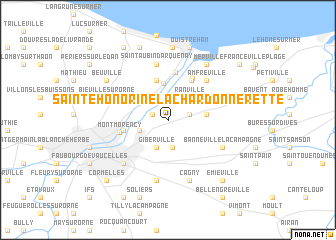
Sainte-Honorine-la-Chardonnerette (Basse-Normandie, France)Sainte-Honorine-la-Chardonnerette is a town in the Basse-Normandie region of France. An overview map of the region around Sainte-Honorine-la-Chardonnerette is displayed below.
regional and 3d topo map of Sainte-Honorine-la-Chardonnerette, France ::
Sainte-Honorine-la-Chardonnerette airports ::
The nearest airport is CFR - Caen Carpiquet, located 13.7 km west of Sainte-Honorine-la-Chardonnerette.
Other airports nearby include DOL - Deauville St Gatien (35.4 km north east), LEH - Le Havre Octeville (44.4 km north east), CER - Cherbourg Maupertus (99.7 km north west), URO - Rouen Vallee De Seine (107.0 km east), Nearby towns ::
Longueval (1.3km north west) //
Escoville (1.7km east) //
Démouville (3.1km south) //
Cuverville (3.1km south) //
Le Parc (2.9km north) //
Giberville (3.2km south) //
Colombelles (2.4km south west) //
Ranville (3.0km north east) //
Blainville-sur-Orne (3.2km north west) //
Le Port (4.1km north) //
Hérouvillette (2.9km east) //
Bénouville (4.4km north) //
Bréville (3.7km north east) //
La Haute Ecarde (4.7km north) //
Hérouville-Saint-Clair (3.5km west) //
Le Maresquier (5.3km north) //
La Basse Ecarde (5.0km north) //
Montmorency (3.8km west) //
Amfréville (5.2km north east) //
Saint-Aubin-dʼArquenay (6.3km north) //
Sannerville (5.0km south east) //
Banneville-la-Campagne (5.0km south east) //
Touffréville (5.0km south east) //
Grentheville (6.8km south) //
Mondeville (5.9km south west) //
Cagny (6.9km south) //
Biéville-sur-Orne (5.1km north west) //
Sallenelles (6.8km north east) //
Riva-Bella (8.1km north) //
[all distances 'as the bird flies' and approximate] 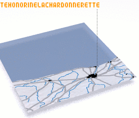 Places with similar names to Sainte-Honorine-la-Chardonnerette, France ::
// Sainte-Honorine-la-Chardonne (FR)
Disclaimer :: Information on this page comes without warranty of any kind |
||
|
Where is Sainte-Honorine-la-Chardonnerette? Elevation and coordinates ::
Latitude (lat): 49°12'39"N Longitude (lon): 0°16'18"W
Elevation (approx.): 33m (map arrows pan, magnifying glasses zoom) |
||
|
Visiting Sainte-Honorine-la-Chardonnerette? Hotel/Accommodation ::
Book a hotel in Sainte-Honorine-la-Chardonnerette Travel Guide ::
Buy a travel guide for France rental cars ::
car rental offers GPS waypoint ::
download a GPX waypoint (PoI) of Sainte-Honorine-la-Chardonnerette for your GPS receiver
|
||