|
search place name
|
||
Sainte-Terre (Aquitaine, France)Sainte-Terre is a town in the Aquitaine region of France. An overview map of the region around Sainte-Terre is displayed below.
regional and 3d topo map of Sainte-Terre, France ::

Sainte-Terre airports ::
The nearest airport is BOD - Bordeaux Merignac, located 47.4 km west of Sainte-Terre.
Other airports nearby include EGC - Bergerac Roumaniere (50.2 km east), XAC - Arcachon La Teste De Buch (83.1 km west), PGX - Perigueux Bassillac (83.9 km north east), AGF - Agen La Garenne (92.3 km south east), Nearby towns ::
Saint-Jean-de-Blaignac (2.3km south west) //
Saint-Vincent-de-Pertignas (3.7km south) //
Civrac-de-Dordogne (2.6km east) //
Sainte-Florence (3.9km south) //
Rauzan (5.6km south) //
Saint-Laurent-des-Combes (5.7km north) //
Saint-Pey-de-Castets (4.4km south east) //
Cabara (4.4km south west) //
Saint-Hippolyte (5.7km north) //
Saint-Étienne-de-Lisse (5.7km north) //
Saint-Christophe-des-Bardes (5.7km north) //
Vignonet (4.4km north west) //
Saint-Émilion (6.1km north west) //
Saint-Aubin-de-Branne (5.4km south west) //
Mérignas (6.2km south east) //
Saint-Magne-de-Castillon (5.4km north east) //
Sainte-Colombe (5.4km north east) //
Branne (5.3km west) //
Lugaignac (5.6km west) //
Parsac (7.5km north) //
Jugazan (6.8km south west) //
Saint-Sulpice-de-Faleyrens (6.4km north west) //
Naujan-et-Postiac (7.7km south west) //
Bossugan (7.7km south east) //
Saint-Genès-de-Castillon (8.4km north east) //
Bellefond (9.1km south west) //
Romagne (9.1km south west) //
[all distances 'as the bird flies' and approximate] 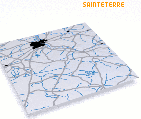 Places with similar names to Sainte-Terre, France ::
// Santo Adrião (PT)
// Santo Adrião (PT)
// Santadrao (ES)
// Soundoutourou (SN)
// Saint-Diéry (FR)
// Sainte-Trie (FR)
// San Teodoro (IT)
// San Teodoro (PH)
// Saint-Théodore (FR)
Disclaimer :: Information on this page comes without warranty of any kind |
||
|
Where is Sainte-Terre? Elevation and coordinates ::
Latitude (lat): 44°50'0"N Longitude (lon): 0°7'0"W
Elevation (approx.): 6m (map arrows pan, magnifying glasses zoom) |
||
|
Visiting Sainte-Terre? Hotel/Accommodation ::
Book a hotel in Sainte-Terre Travel Guide ::
Buy a travel guide for France rental cars ::
car rental offers GPS waypoint ::
download a GPX waypoint (PoI) of Sainte-Terre for your GPS receiver
|
||