|
search place name
|
||
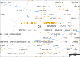
Saint-Étienne-de-Puycorbier (Aquitaine, France)Saint-Étienne-de-Puycorbier is a town in the Aquitaine region of France. An overview map of the region around Saint-Étienne-de-Puycorbier is displayed below.
regional and 3d topo map of Saint-Étienne-de-Puycorbier, France ::
Saint-Étienne-de-Puycorbier airports ::
The nearest airport is EGC - Bergerac Roumaniere, located 33.8 km south east of Saint-Étienne-de-Puycorbier.
Other airports nearby include PGX - Perigueux Bassillac (39.5 km east), ANG - Angouleme Brie Champniers (70.5 km north), CNG - Cognac Chateaubernard (80.3 km north west), BOD - Bordeaux Merignac (88.1 km west), Nearby towns ::
Renolphie (1.9km south) //
Les Murgeaux (2.3km north west) //
Les Mignots (3.7km north) //
Faye (3.2km south east) //
Tonnaigre (3.2km south east) //
Coutancias (3.2km north east) //
Beauronne (3.9km east) //
Saint-Martin-lʼAstier (5.6km south) //
Saint-André-de-Double (5.7km north) //
La Cabane (5.7km north) //
Saint-Michel-de-Double (4.3km south west) //
Le Treuil (4.3km north east) //
Saint-Front-de-Pradoux (5.7km south) //
Laveyssière (5.4km north east) //
Lamaud (6.1km north east) //
Rouzellou (6.1km south east) //
Saint-Médard-de-Mussidan (7.5km south) //
Léonards Petits (7.5km north) //
Sirieix (6.8km north east) //
Couturou (6.8km south east) //
Puy de Siorac (6.4km north east) //
Saint-Louis-en-lʼIsle (6.4km south east) //
Lamelette (6.4km south east) //
Cubnezais (6.4km south east) //
Beaufort (6.4km south east) //
Mussidan (7.9km south) //
Saint-Jean-de-Ataux (7.6km north east) //
Le Bost (8.4km south east) //
Sourzac (7.6km south east) //
[all distances 'as the bird flies' and approximate] 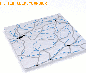 Places with similar names to Saint-Étienne-de-Puycorbier, France :: Disclaimer :: Information on this page comes without warranty of any kind |
||
|
Where is Saint-Étienne-de-Puycorbier? Elevation and coordinates ::
Latitude (lat): 45°6'0"N Longitude (lon): 0°20'0"W
Elevation (approx.): 98m (map arrows pan, magnifying glasses zoom) |
||
|
Visiting Saint-Étienne-de-Puycorbier? Hotel/Accommodation ::
Book a hotel in Saint-Étienne-de-Puycorbier Travel Guide ::
Buy a travel guide for France rental cars ::
car rental offers GPS waypoint ::
download a GPX waypoint (PoI) of Saint-Étienne-de-Puycorbier for your GPS receiver
|
||