|
search place name
|
||
Saint-Étienne-des-Champs (Auvergne, France)Saint-Étienne-des-Champs is a town in the Auvergne region of France. An overview map of the region around Saint-Étienne-des-Champs is displayed below.
regional and 3d topo map of Saint-Étienne-des-Champs, France ::

Saint-Étienne-des-Champs airports ::
The nearest airport is CFE - Clermont Ferrand Auvergne, located 45.8 km east of Saint-Étienne-des-Champs.
Other airports nearby include MCU - Montlucon-gueret Montlucon Gueret (46.5 km north), MCU - Montlucon Domerat (57.7 km north), VHY - Vichy Charmeil (73.7 km north east), XMU - Moulins Montbeugny (101.4 km north east), Nearby towns ::
Condat-en-Combraille (2.3km north west) //
La Barague (2.3km north east) //
Pardellières (3.9km south) //
La Chaud (3.2km north west) //
Le Cheval-Blanc (3.9km north) //
Combrailles (3.9km east) //
Le Triadoux (3.9km east) //
Le Roumaneix (3.9km west) //
Les Huillards (5.7km north) //
Le Grand Léger (5.7km north) //
La Rodde (4.3km north east) //
Marcollange (4.3km north west) //
Les Aymards (6.1km south west) //
Voingt (5.4km south west) //
Saint-Avit (5.4km north west) //
Chantemerle (7.4km south) //
Vatanges (5.2km west) //
Saint-Bard (7.5km north) //
Tralaigues (7.5km north) //
La Croix (6.8km south east) //
Puy Saint-Gulmier (6.8km south east) //
La Villatte (6.4km south west) //
Sauvagnat (7.9km south) //
Fargoulas (6.4km south east) //
LʼEclause (7.6km north west) //
Foulage (7.6km south west) //
Verneugheol (8.4km south west) //
Trabatergue (9.0km south west) //
Les Isserts (9.0km north east) //
[all distances 'as the bird flies' and approximate] 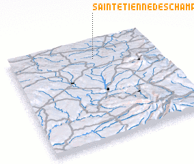 Places with similar names to Saint-Étienne-des-Champs, France :: Disclaimer :: Information on this page comes without warranty of any kind |
||
|
Where is Saint-Étienne-des-Champs? Elevation and coordinates ::
Latitude (lat): 45°50'0"N Longitude (lon): 2°35'0"E
Elevation (approx.): 726m (map arrows pan, magnifying glasses zoom) |
||
|
Visiting Saint-Étienne-des-Champs? Hotel/Accommodation ::
Book a hotel in Saint-Étienne-des-Champs Travel Guide ::
Buy a travel guide for France rental cars ::
car rental offers GPS waypoint ::
download a GPX waypoint (PoI) of Saint-Étienne-des-Champs for your GPS receiver
|
||