|
search place name
|
||
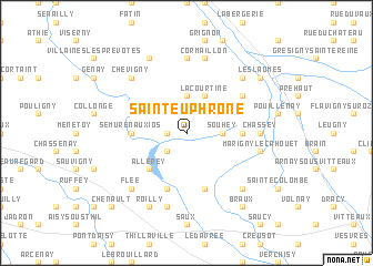
Saint-Euphrône (Bourgogne, France)Saint-Euphrône is a town in the Bourgogne region of France. An overview map of the region around Saint-Euphrône is displayed below.
regional and 3d topo map of Saint-Euphrône, France ::
Saint-Euphrône airports ::
The nearest airport is DIJ - Dijon Longvic, located 58.5 km south east of Saint-Euphrône.
Other airports nearby include AUF - Auxerre Branches (78.1 km north west), XCD - Chalon Champforgeuil (80.1 km south east), DLE - Dole Tavaux (93.2 km south east), QYR - Troyes Barberey (97.2 km north), Nearby towns ::
Massène (1.3km west) //
Villenotte (1.9km north) //
Pont-et-Massène (2.2km south west) //
Juilly (2.2km north east) //
Souhey (2.5km east) //
Villars-et-Villenotte (3.7km north) //
Massingy-lès-Semur (3.9km north) //
La Courtine (3.9km north) //
Allerey (4.5km south west) //
Magny-la-Ville (3.8km east) //
Semur-en-Auxios (3.8km west) //
Montigny-sur-Armançon (5.7km south) //
Villeneuve-sous-Charigny (5.7km south) //
Charentois (4.2km north west) //
Mussy-la-Fosse (5.3km north east) //
Lantilly (7.4km north) //
Chassey (5.0km east) //
Brianny (7.5km south) //
Marigny-le-Cahouet (5.3km east) //
Cormaillon (7.5km north) //
Charigny (6.7km south east) //
Flée (6.7km south west) //
Venarey-les-Laumes (6.7km north east) //
Chevigny (6.7km north west) //
Roilly (7.8km south) //
Champ dʼOiseau (7.8km north) //
Braux (8.3km south east) //
La Croisée (8.3km south east) //
Les Laumes (7.5km north east) //
[all distances 'as the bird flies' and approximate] 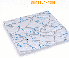 Places with similar names to Saint-Euphrône, France ::
// Saint Vrain (US)
// Saint-Frion (FR)
// Saint-Vérain (FR)
// Saint-Véran (FR)
// Saint-Vrain (FR)
// Saint-Vrain (FR)
// Saint-Vran (FR)
// Saint-Véran (FR)
// Sint-Verone (BE)
Disclaimer :: Information on this page comes without warranty of any kind |
||
|
Where is Saint-Euphrône? Elevation and coordinates ::
Latitude (lat): 47°29'0"N Longitude (lon): 4°23'0"E
Elevation (approx.): 290m (map arrows pan, magnifying glasses zoom) |
||
|
Visiting Saint-Euphrône? Hotel/Accommodation ::
Book a hotel in Saint-Euphrône Travel Guide ::
Buy a travel guide for France rental cars ::
car rental offers GPS waypoint ::
download a GPX waypoint (PoI) of Saint-Euphrône for your GPS receiver
|
||