|
search place name
|
||
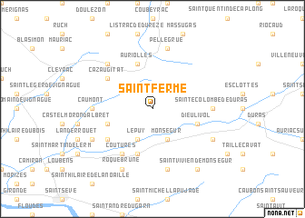
Saint-Ferme (Aquitaine, France)Saint-Ferme is a town in the Aquitaine region of France. An overview map of the region around Saint-Ferme is displayed below.
regional and 3d topo map of Saint-Ferme, France ::
Saint-Ferme airports ::
The nearest airport is EGC - Bergerac Roumaniere, located 39.1 km north east of Saint-Ferme.
Other airports nearby include BOD - Bordeaux Merignac (64.0 km west), AGF - Agen La Garenne (70.2 km south east), PGX - Perigueux Bassillac (82.3 km north east), XAC - Arcachon La Teste De Buch (93.9 km west), Nearby towns ::
Monségur (3.9km south) //
Le Puy (3.9km south) //
Rimons (4.4km south west) //
Dieulivol (4.4km south east) //
Auriolles (5.7km north) //
Saint-Sulpice-de-Guilleragues (5.7km south) //
Neuffons (5.4km south west) //
Cazaugitat (5.4km north west) //
Coutures (6.2km south west) //
Sainte-Colombe-de-Duras (5.3km east) //
Caumont (5.3km west) //
Sainte-Gemme (7.5km south) //
Pellegrue (7.5km north) //
Soussac (6.8km north west) //
Cours-de-Monségur (6.4km south east) //
Roquebrune (7.9km south) //
Saint-Sauveur-de-Meilhan (6.4km south west) //
Saint-Vivien-de-Monségur (8.4km south east) //
[all distances 'as the bird flies' and approximate] 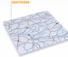 Places with similar names to Saint-Ferme, France :: Disclaimer :: Information on this page comes without warranty of any kind |
||
|
Where is Saint-Ferme? Elevation and coordinates ::
Latitude (lat): 44°41'0"N Longitude (lon): 0°4'0"W
Elevation (approx.): 90m (map arrows pan, magnifying glasses zoom) |
||
|
Visiting Saint-Ferme? Hotel/Accommodation ::
Book a hotel in Saint-Ferme Travel Guide ::
Buy a travel guide for France rental cars ::
car rental offers GPS waypoint ::
download a GPX waypoint (PoI) of Saint-Ferme for your GPS receiver
|
||