|
search place name
|
||
Saint-Gondon (Centre, France)Saint-Gondon is a town in the Centre region of France. An overview map of the region around Saint-Gondon is displayed below.
regional and 3d topo map of Saint-Gondon, France ::

Saint-Gondon airports ::
The nearest airport is ORE - Orleans Bricy, located 66.1 km north west of Saint-Gondon.
Other airports nearby include BOU - Bourges (72.4 km south), AUF - Auxerre Branches (74.1 km east), NVS - Nevers Fourchambault (89.1 km south east), CHR - Chateauroux Deols (111.2 km south west), Nearby towns ::
La Ronce (2.2km north west) //
Arcole (2.2km north east) //
Les Guérets (3.7km north) //
Les Rossignols (3.1km south west) //
Montoire (3.1km north east) //
Les Salons (5.6km south) //
Nevoy (4.2km north east) //
Saint-Florent-le-Jeune (4.2km south west) //
Lion-en-Sullias (5.3km north west) //
Benne (6.1km north west) //
Les Museaux (7.4km north) //
Dampierre-en-Burly (7.5km north) //
Poilly-lez-Gien (5.3km east) //
Coursel (6.2km south east) //
Cuissy (7.5km north west) //
Ouzouer-sur-Loire (8.3km north west) //
Le Taureau (8.3km south west) //
Les Bruyères (8.3km south east) //
[all distances 'as the bird flies' and approximate] 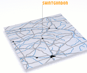 Places with similar names to Saint-Gondon, France ::
// San Diego Notano (MX)
// Saint-Quentin (FR)
// Saint Quentin (CA)
// Saint-Quentin (FR)
// Saint-Ganton (FR)
// Saint-Quentin (FR)
// Saint-Quentin (FR)
// Saint-Quentin (FR)
Disclaimer :: Information on this page comes without warranty of any kind |
||
|
Where is Saint-Gondon? Elevation and coordinates ::
Latitude (lat): 47°42'0"N Longitude (lon): 2°32'0"E
Elevation (approx.): 131m (map arrows pan, magnifying glasses zoom) |
||
|
Visiting Saint-Gondon? Hotel/Accommodation ::
Book a hotel in Saint-Gondon Travel Guide ::
Buy a travel guide for France rental cars ::
car rental offers GPS waypoint ::
download a GPX waypoint (PoI) of Saint-Gondon for your GPS receiver
|
||