|
search place name
|
||
Saint-Laurent (Haute-Normandie, France)Saint-Laurent is a town in the Haute-Normandie region of France. An overview map of the region around Saint-Laurent is displayed below.
regional and 3d topo map of Saint-Laurent, France ::

Saint-Laurent airports ::
The nearest airport is URO - Rouen Vallee De Seine, located 30.1 km south west of Saint-Laurent.
Other airports nearby include BVA - Beauvais Tille (41.1 km east), POX - Pontoise Cormeilles En Vexin (57.3 km south east), CSF - Creil (75.5 km east), LBG - Paris Le Bourget (87.7 km south east), Nearby towns ::
Les Dutots (2.4km east) //
Le Mesnil-Lieubray (2.4km west) //
Beauvoir-en-Lyons (2.4km east) //
La Vente (3.0km north west) //
Hodeng-Hodenger (3.9km north) //
Fry (3.9km north) //
LʼÉtang-Bertrand (3.9km south) //
Argueil (4.4km north west) //
La Feuillie (4.4km south west) //
Le Camp Jean (4.4km south west) //
La Vierge (5.7km north) //
Les Ventes (5.7km south) //
Les Bruyères (5.7km north) //
Mésangueville (5.7km north) //
Merval (4.1km north east) //
Yvetot-Bocage (4.1km south west) //
Launay (5.2km north west) //
Entre-Deux-Landes (5.2km south west) //
Richebourg (5.2km south west) //
Brémontier-Merval (4.8km east) //
Montagny (4.8km west) //
Nolléval (4.8km west) //
Glatigny (7.5km north) //
Écorcheval (7.5km south) //
La Lande (5.2km east) //
Le Fouras (5.2km west) //
Valroufié (5.2km west) //
Sigy-en-Bray (6.6km north west) //
Béthencourt (7.4km north west) //
[all distances 'as the bird flies' and approximate] 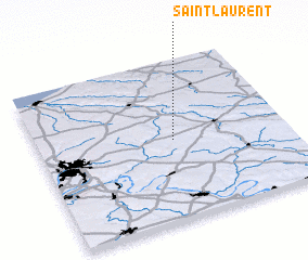 Places with similar names to Saint-Laurent, France ::
// Saint Laurent (TN)
// Saint Laurent (HT)
// Saint-Laurent (FR)
// Saint-Laurent (FR)
// Saint-Laurent (FR)
// Saint-Laurent (FR)
// Saint-Laurent (FR)
// Saint-Laurent (FR)
// Saint-Laurent (FR)
// Saint-Laurent (CA)
Disclaimer :: Information on this page comes without warranty of any kind |
||
|
Where is Saint-Laurent? Elevation and coordinates ::
Latitude (lat): 49°30'0"N Longitude (lon): 1°33'0"E
Elevation (approx.): 219m (map arrows pan, magnifying glasses zoom) |
||
|
Visiting Saint-Laurent? Hotel/Accommodation ::
Book a hotel in Saint-Laurent Travel Guide ::
Buy a travel guide for France rental cars ::
car rental offers GPS waypoint ::
download a GPX waypoint (PoI) of Saint-Laurent for your GPS receiver
|
||