|
search place name
|
||
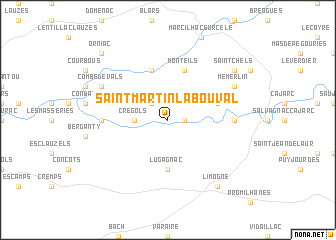
Saint-Martin-Labouval (Midi-Pyrénées, France)Saint-Martin-Labouval is a town in the Midi-Pyrénées region of France. An overview map of the region around Saint-Martin-Labouval is displayed below.
regional and 3d topo map of Saint-Martin-Labouval, France ::
Saint-Martin-Labouval airports ::
The nearest airport is RDZ - Rodez Marcillac, located 60.0 km east of Saint-Martin-Labouval.
Other airports nearby include LBI - Albi Le Sequestre (68.5 km south east), AUR - Aurillac (72.2 km north east), BVE - Brive La Roche (78.8 km north), AGF - Agen La Garenne (96.8 km west), Nearby towns ::
Cénevières (1.3km east) //
Nougayrac (2.3km north west) //
Tour-de-Faure (2.6km west) //
Crégols (2.6km west) //
Lugagnac (5.6km south) //
Larnagol (4.4km north east) //
Sauliac-sur-Célé (5.7km north) //
Monteils (5.7km north) //
Saint-Cirq-Lapopie (5.3km west) //
Calvignac (5.3km east) //
Combe de Vals (6.5km north west) //
Memerlin (6.5km north east) //
Limogne (8.4km south east) //
Saint-Chels (7.7km north east) //
Orniac (9.1km north west) //
[all distances 'as the bird flies' and approximate] 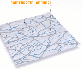 Places with similar names to Saint-Martin-Labouval, France :: Disclaimer :: Information on this page comes without warranty of any kind |
||
|
Where is Saint-Martin-Labouval? Elevation and coordinates ::
Latitude (lat): 44°28'0"N Longitude (lon): 1°44'0"E
Elevation (approx.): 169m (map arrows pan, magnifying glasses zoom) |
||
|
Visiting Saint-Martin-Labouval? Hotel/Accommodation ::
Book a hotel in Saint-Martin-Labouval Travel Guide ::
Buy a travel guide for France rental cars ::
car rental offers GPS waypoint ::
download a GPX waypoint (PoI) of Saint-Martin-Labouval for your GPS receiver
|
||