|
search place name
|
||
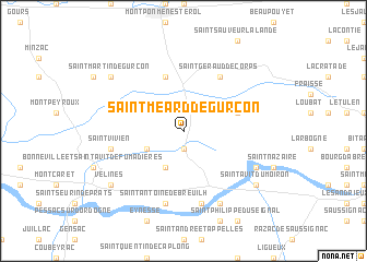
Saint-Méard-de-Gurçon (Aquitaine, France)Saint-Méard-de-Gurçon is a town in the Aquitaine region of France. An overview map of the region around Saint-Méard-de-Gurçon is displayed below.
regional and 3d topo map of Saint-Méard-de-Gurçon, France ::
Saint-Méard-de-Gurçon airports ::
The nearest airport is EGC - Bergerac Roumaniere, located 27.8 km east of Saint-Méard-de-Gurçon.
Other airports nearby include PGX - Perigueux Bassillac (59.8 km north east), BOD - Bordeaux Merignac (71.5 km west), AGF - Agen La Garenne (86.9 km south), ANG - Angouleme Brie Champniers (92.2 km north), Nearby towns ::
Ponchapt (1.9km south) //
Fougueyrolles (3.9km south) //
Nastringues (3.9km south) //
Montazeau (3.2km south west) //
Saint-Rémy (5.7km north) //
Monfaucon (4.4km north east) //
Saint-Géraud-de-Corps (6.1km north east) //
Saint-Vivien (5.6km west) //
Saint-Antoine-de-Breuilh (7.5km south) //
Port-Sainte-Foy-et-Ponchapt (7.5km south) //
Le Fleix (6.4km south east) //
Sainte-Foy-la-Grande (7.9km south) //
Vélines (7.6km south west) //
Saint-Martin-de-Gurçon (7.6km north west) //
Saint-Avit-du-Moiron (7.6km south east) //
[all distances 'as the bird flies' and approximate] 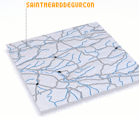 Places with similar names to Saint-Méard-de-Gurçon, France :: Disclaimer :: Information on this page comes without warranty of any kind |
||
|
Where is Saint-Méard-de-Gurçon? Elevation and coordinates ::
Latitude (lat): 44°54'0"N Longitude (lon): 0°11'0"W
Elevation (approx.): 68m (map arrows pan, magnifying glasses zoom) |
||
|
Visiting Saint-Méard-de-Gurçon? Hotel/Accommodation ::
Book a hotel in Saint-Méard-de-Gurçon Travel Guide ::
Buy a travel guide for France rental cars ::
car rental offers GPS waypoint ::
download a GPX waypoint (PoI) of Saint-Méard-de-Gurçon for your GPS receiver
|
||