|
search place name
|
||
Saint-Ouen-des-Champs (Haute-Normandie, France)Saint-Ouen-des-Champs is a town in the Haute-Normandie region of France. An overview map of the region around Saint-Ouen-des-Champs is displayed below.
regional and 3d topo map of Saint-Ouen-des-Champs, France ::

Saint-Ouen-des-Champs airports ::
The nearest airport is DOL - Deauville St Gatien, located 28.8 km west of Saint-Ouen-des-Champs.
Other airports nearby include LEH - Le Havre Octeville (37.4 km north west), URO - Rouen Vallee De Seine (45.4 km east), CFR - Caen Carpiquet (76.4 km west), POX - Pontoise Cormeilles En Vexin (113.1 km east), Nearby towns ::
Fourmetot (1.2km east) //
Saint-Thurien (1.9km north) //
Les Granges (2.2km north west) //
Saint-Mards-de-Blacarville (3.0km south west) //
Bourdon (3.0km south west) //
Manneville-sur-Risle (3.9km south) //
La Vallée (3.0km north west) //
Trouville-la-Haule (3.9km north) //
La Mare Bardin (3.9km north) //
Sainte-Opportune-la-Mare (3.9km north) //
Le Carrefour (4.7km north) //
Le Bout-Deshayes (5.1km north) //
Pont-Audemer (4.4km south west) //
Le Val-Anger (4.4km north east) //
La Brehallerie (4.1km south west) //
Saint-Paul-sur-Risle (5.7km south) //
La Cabotterie (4.1km north east) //
Saint-Germain-Village (5.2km south west) //
Campigny (7.4km south) //
Bourneville (4.8km east) //
Valletot (5.2km east) //
Tocqueville (5.2km east) //
Bouquelon (5.2km west) //
Le Grand Saint-Aubin (7.5km north) //
Tourville-sur-Pont-Audemer (6.6km south west) //
Vieux-Port (6.6km north east) //
Le Petit-Saint-Aubin (7.8km north) //
Corneville-sur-Risle (7.4km south east) //
Les Nouettes (8.2km north east) //
[all distances 'as the bird flies' and approximate] 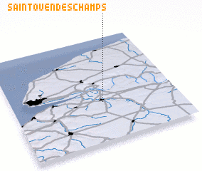 Places with similar names to Saint-Ouen-des-Champs, France :: Disclaimer :: Information on this page comes without warranty of any kind |
||
|
Where is Saint-Ouen-des-Champs? Elevation and coordinates ::
Latitude (lat): 49°23'0"N Longitude (lon): 0°33'0"W
Elevation (approx.): 132m (map arrows pan, magnifying glasses zoom) |
||
|
Visiting Saint-Ouen-des-Champs? Hotel/Accommodation ::
Book a hotel in Saint-Ouen-des-Champs Travel Guide ::
Buy a travel guide for France rental cars ::
car rental offers GPS waypoint ::
download a GPX waypoint (PoI) of Saint-Ouen-des-Champs for your GPS receiver
|
||