|
search place name
|
||
Saint-Pons (Rhône-Alpes, France)Saint-Pons is a town in the Rhône-Alpes region of France. An overview map of the region around Saint-Pons is displayed below.
regional and 3d topo map of Saint-Pons, France ::

Saint-Pons airports ::
The nearest airport is OBS - Aubenas-vals-lanas Ardeche Meridionale, located 17.3 km west of Saint-Pons.
Other airports nearby include VAF - Valence Chabeuil (48.5 km north east), AVN - Avignon Caumont (79.3 km south), MEN - Mende Brenoux (84.0 km west), LPY - Le Puy Loudes (85.2 km north west), Nearby towns ::
Aubignas (2.6km east) //
Berzème (5.6km north) //
Saint-Jean-le-Centenier (4.0km west) //
Saint-Gineis-en-Coiron (6.2km north west) //
Alba (5.4km south east) //
Sceautres (5.4km north east) //
Mirabel (5.6km west) //
Saint-Pierre-la-Roche (7.9km north) //
Darbres (7.7km north west) //
Saint-Andéol-de-Berg (8.4km south west) //
Saint-Martin-le-Supérieur (7.7km north east) //
[all distances 'as the bird flies' and approximate] 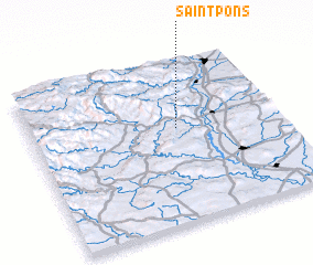 Places with similar names to Saint-Pons, France ::
// Sandy Pines (US)
// Saint-Poncy (FR)
// Saint-Pons (FR)
// Saint-Pons (FR)
// Santiponce (ES)
// Santiponce (BO)
// Sainte-Pience (FR)
// Saint-Pons (FR)
// Saint-Pons (FR)
Disclaimer :: Information on this page comes without warranty of any kind |
||
|
Where is Saint-Pons? Elevation and coordinates ::
Latitude (lat): 44°35'0"N Longitude (lon): 4°35'0"E
Elevation (approx.): 322m (map arrows pan, magnifying glasses zoom) |
||
|
Visiting Saint-Pons? Hotel/Accommodation ::
Book a hotel in Saint-Pons Travel Guide ::
Buy a travel guide for France rental cars ::
car rental offers GPS waypoint ::
download a GPX waypoint (PoI) of Saint-Pons for your GPS receiver
|
||