|
search place name
|
||
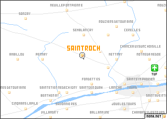
Saint-Roch (Centre, France)Saint-Roch is a town in the Centre region of France. An overview map of the region around Saint-Roch is displayed below.
regional and 3d topo map of Saint-Roch, France ::
Saint-Roch airports ::
The nearest airport is TUF - Tours Val De Loire, located 11.1 km east of Saint-Roch.
Other airports nearby include LME - Le Mans Arnage (62.4 km north west), PIS - Poitiers Biard (98.1 km south), ORE - Orleans Bricy (106.7 km north east), CHR - Chateauroux Deols (108.8 km south east), Nearby towns ::
Charentilly (3.1km north east) //
Semblançay (5.6km north) //
La Membrolle-sur-Choisille (4.2km south east) //
Fondettes (5.7km south) //
Mettray (5.0km east) //
Saint-Genouph (7.5km south) //
Saint-Antoine-du-Rocher (6.7km north east) //
Luynes (7.8km south) //
Saint-Étienne-de-Chigny (8.3km south west) //
Rouziers-de-Touraine (8.9km north east) //
La Riche (9.0km south east) //
[all distances 'as the bird flies' and approximate] 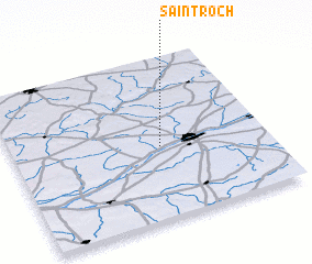 Places with similar names to Saint-Roch, France ::
// Centereach (US)
// Sindurātia (BD)
// Centrache (IT)
// Saint-Roch (CA)
// Saint-Racho (FR)
// Xuân Trach (VN)
// Xuân Trạch (VN)
// Saint-Roch (FR)
// Saint-Roch (FR)
// Saint-Roch (FR)
Disclaimer :: Information on this page comes without warranty of any kind |
||
|
Where is Saint-Roch? Elevation and coordinates ::
Latitude (lat): 47°27'0"N Longitude (lon): 0°35'0"W
Elevation (approx.): 97m (map arrows pan, magnifying glasses zoom) |
||
|
Visiting Saint-Roch? Hotel/Accommodation ::
Book a hotel in Saint-Roch Travel Guide ::
Buy a travel guide for France rental cars ::
car rental offers GPS waypoint ::
download a GPX waypoint (PoI) of Saint-Roch for your GPS receiver
|
||