|
search place name
|
||
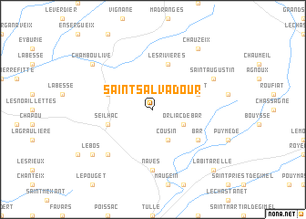
Saint-Salvadour (Limousin, France)Saint-Salvadour is a town in the Limousin region of France. An overview map of the region around Saint-Salvadour is displayed below.
regional and 3d topo map of Saint-Salvadour, France ::
Saint-Salvadour airports ::
The nearest airport is BVE - Brive La Roche, located 34.8 km south west of Saint-Salvadour.
Other airports nearby include LIG - Limoges Bellegarde (70.3 km north west), AUR - Aurillac (75.1 km south east), PGX - Perigueux Bassillac (77.4 km west), MCU - Montlucon-gueret Montlucon Gueret (104.2 km north east), Nearby towns ::
Cousin (3.9km south) //
Orliac-de-Bar (3.2km south east) //
Seilhac (4.3km south west) //
Les Rivières (5.7km north) //
Sarlat (4.3km north east) //
Chalaux (4.3km north west) //
Bar (5.4km south east) //
Naves (7.4km south) //
Céron (6.8km south west) //
Saint-Augustin (6.4km north east) //
Le Bos (7.6km south west) //
Chamboulive (7.6km north west) //
Chauzeix (8.4km north east) //
La Bitarelle (9.1km south east) //
[all distances 'as the bird flies' and approximate] 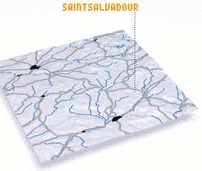 Places with similar names to Saint-Salvadour, France ::
// Sant Salvador (ES)
Disclaimer :: Information on this page comes without warranty of any kind |
||
|
Where is Saint-Salvadour? Elevation and coordinates ::
Latitude (lat): 45°23'0"N Longitude (lon): 1°46'0"E
Elevation (approx.): 424m (map arrows pan, magnifying glasses zoom) |
||
|
Visiting Saint-Salvadour? Hotel/Accommodation ::
Book a hotel in Saint-Salvadour Travel Guide ::
Buy a travel guide for France rental cars ::
car rental offers GPS waypoint ::
download a GPX waypoint (PoI) of Saint-Salvadour for your GPS receiver
|
||