|
search place name
|
||
Saint-Sornin (Poitou-Charentes, France)Saint-Sornin is a town in the Poitou-Charentes region of France. An overview map of the region around Saint-Sornin is displayed below.
regional and 3d topo map of Saint-Sornin, France ::

Saint-Sornin airports ::
The nearest airport is ANG - Angouleme Brie Champniers, located 16.8 km west of Saint-Sornin.
Other airports nearby include CNG - Cognac Chateaubernard (58.7 km west), LIG - Limoges Bellegarde (60.8 km east), PGX - Perigueux Bassillac (63.3 km south east), NIT - Niort Souche (93.8 km north west), Nearby towns ::
Les Chaumes (1.9km north) //
Louzac (2.3km north west) //
Vilhonneur (2.3km south west) //
La Vallade (2.3km north east) //
Roland (2.3km south east) //
Marillac (3.7km north) //
Rancogne (2.6km west) //
Lachaise (3.7km south) //
Miaulant (3.2km north east) //
Le Mas (3.2km south east) //
Malleyrand (4.5km north east) //
Vouthon (4.5km south east) //
Le Mas de Baud (5.7km south) //
Yvrac-et-Malleyrand (5.7km north) //
La Rochefoucauld (5.4km north west) //
Saint-Paul (5.4km south west) //
Grignol (5.4km south east) //
Fleurignac (7.4km north) //
Orgedeuil (5.2km east) //
Saint-Germain-de-Montbron (7.5km south) //
La Ménardie (6.8km north east) //
Montbron (6.4km south east) //
Lavaud (7.6km north west) //
Chazelles (7.6km south west) //
Saint-Adjutory (8.4km north east) //
Les Brousses (7.6km south east) //
LʼAge Martin (8.4km south west) //
Le Grand Maine (9.0km south west) //
Chez Vincent (9.0km south east) //
[all distances 'as the bird flies' and approximate] 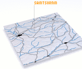 Places with similar names to Saint-Sornin, France ::
// Saint-Sernin (FR)
// Saint-Sernin (FR)
// Saint-Sornin (FR)
// Saint-Sornin (FR)
// Saint-Cernin (FR)
// Saint-Cernin (FR)
// Saint-Cernin (FR)
// Saint-Sernin (FR)
// Saint-Sornin (FR)
// Saint-Sornin (FR)
Disclaimer :: Information on this page comes without warranty of any kind |
||
|
Where is Saint-Sornin? Elevation and coordinates ::
Latitude (lat): 45°42'0"N Longitude (lon): 0°26'0"W
Elevation (approx.): 120m (map arrows pan, magnifying glasses zoom) |
||
|
Visiting Saint-Sornin? Hotel/Accommodation ::
Book a hotel in Saint-Sornin Travel Guide ::
Buy a travel guide for France rental cars ::
car rental offers GPS waypoint ::
download a GPX waypoint (PoI) of Saint-Sornin for your GPS receiver
|
||