|
search place name
|
||
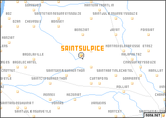
Saint-Sulpice (Rhône-Alpes, France)Saint-Sulpice is a town in the Rhône-Alpes region of France. An overview map of the region around Saint-Sulpice is displayed below.
regional and 3d topo map of Saint-Sulpice, France ::
Saint-Sulpice airports ::
The nearest airport is QNX - Macon Charnay, located 19.7 km west of Saint-Sulpice.
Other airports nearby include XBK - Bourg Ceyzeriat (22.7 km south east), XVF - Vilefrance Tarare (56.2 km south west), XCD - Chalon Champforgeuil (59.4 km north), LYS - Lyon Saint Exupery (65.7 km south), Nearby towns ::
Marsonnas (2.3km north east) //
Saint-Didier-dʼAussiat (2.3km south east) //
Saint-Genis-sur-Menthon (4.5km south west) //
Béréziat (5.6km north) //
Confrançon (5.7km south) //
Curtafond (6.1km south east) //
Saint-Martin-le-Châtel (6.3km south east) //
Boissey (8.3km north west) //
Saint-Cyr-sur-Menthon (7.6km south west) //
Jayat (7.6km north east) //
[all distances 'as the bird flies' and approximate] 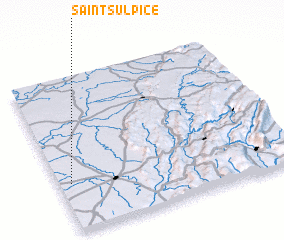 Places with similar names to Saint-Sulpice, France ::
// Saint-Sulpice (CH)
// Saint-Sulpice (CH)
// Saint-Sulpice (FR)
// Saint-Sulpice (FR)
// Saint-Sulpice (FR)
// Saint-Sulpice (FR)
// Saint-Sulpice (FR)
// Saint-Sulpice (FR)
// Saint-Sulpice (FR)
// Saint-Sulpice (FR)
Disclaimer :: Information on this page comes without warranty of any kind |
||
|
Where is Saint-Sulpice? Elevation and coordinates ::
Latitude (lat): 46°19'0"N Longitude (lon): 5°3'0"E
Elevation (approx.): 201m (map arrows pan, magnifying glasses zoom) |
||
|
Visiting Saint-Sulpice? Hotel/Accommodation ::
Book a hotel in Saint-Sulpice Travel Guide ::
Buy a travel guide for France rental cars ::
car rental offers GPS waypoint ::
download a GPX waypoint (PoI) of Saint-Sulpice for your GPS receiver
|
||