|
search place name
|
||
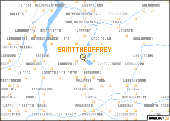
Saint-Théoffrey (Rhône-Alpes, France)Saint-Théoffrey is a town in the Rhône-Alpes region of France. An overview map of the region around Saint-Théoffrey is displayed below.
regional and 3d topo map of Saint-Théoffrey, France ::
Saint-Théoffrey airports ::
The nearest airport is GNB - Grenoble Saint Geoirs, located 54.4 km north west of Saint-Théoffrey.
Other airports nearby include VAF - Valence Chabeuil (63.2 km west), CMF - Chambery Aix Les Bains (73.3 km north), LYS - Lyon Saint Exupery (98.1 km north west), LYN - Lyon Bron (104.8 km north west), Nearby towns ::
Les Gonthéaumes (0.0km north) //
Les Thenaux (1.3km east) //
Lespinasse (1.9km south) //
Notre-Dame-de-Vaux (1.3km west) //
Petichet (1.9km north) //
Les Perrins (2.3km north west) //
Puteville (3.7km south) //
Pierre-Châtel (3.7km south) //
Le Collet (3.7km south) //
Ser-Sigaud (3.9km south) //
Villard-Saint-Christophe (3.2km south east) //
La Motte-dʼAveillans (3.9km south) //
Cholonge (3.2km north east) //
Combefole (3.2km south west) //
Saint-Jean-de-Vaux (3.9km north) //
Fugière (4.5km south east) //
La Coirelle (4.5km north east) //
Villaret (5.6km south) //
Peychagnard (5.6km south) //
Laffrey (5.6km north) //
Comboursière (4.3km south east) //
La Motte-Saint-Martin (5.4km south west) //
Tord (6.1km south east) //
Les Chusins (7.4km south) //
Saint-Pierre-de-Mésage (7.4km north) //
Monteynard (5.6km west) //
Les Blaids (5.6km west) //
Nantes-en-Rattier (6.8km south east) //
Saint-Honoré (6.8km south east) //
[all distances 'as the bird flies' and approximate] 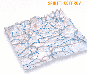 Places with similar names to Saint-Théoffrey, France ::
// Centovera (IT)
// Santo Varão (PT)
// Sundfør (NO)
// Sendvariai (LT)
// Sendvariai (LT)
// Santaveri (IN)
// Santafara (ML)
// Santa Fiora (IT)
// Saint-Avre (FR)
// Sainte-Feyre (FR)
Disclaimer :: Information on this page comes without warranty of any kind |
||
|
Where is Saint-Théoffrey? Elevation and coordinates ::
Latitude (lat): 44°59'0"N Longitude (lon): 5°46'0"E
Elevation (approx.): 1064m (map arrows pan, magnifying glasses zoom) |
||
|
Visiting Saint-Théoffrey? Hotel/Accommodation ::
Book a hotel in Saint-Théoffrey Travel Guide ::
Buy a travel guide for France rental cars ::
car rental offers GPS waypoint ::
download a GPX waypoint (PoI) of Saint-Théoffrey for your GPS receiver
|
||