|
search place name
|
||
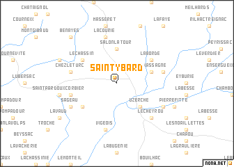
Saint-Ybard (Limousin, France)Saint-Ybard is a town in the Limousin region of France. An overview map of the region around Saint-Ybard is displayed below.
regional and 3d topo map of Saint-Ybard, France ::
Saint-Ybard airports ::
The nearest airport is BVE - Brive La Roche, located 33.6 km south of Saint-Ybard.
Other airports nearby include LIG - Limoges Bellegarde (53.5 km north west), PGX - Perigueux Bassillac (62.9 km south west), AUR - Aurillac (93.5 km south east), EGC - Bergerac Roumaniere (105.8 km south west), Nearby towns ::
Uzerche (4.5km south east) //
Salon-la-Tour (5.6km north) //
La Chassagne (4.3km north east) //
Le Chassin (5.4km north west) //
La Borde (5.4km north east) //
Grand Brugeron (5.4km south west) //
Chez le Turc (5.5km west) //
Saint-Martin-Sepert (5.5km west) //
La Courie (7.5km north) //
Vigeois (7.5km south) //
Condat-sur-Ganaveix (5.5km east) //
Le Cheyrou (6.8km south east) //
Sageau (6.4km south west) //
Espartignac (6.4km south east) //
Benayes (9.1km north west) //
[all distances 'as the bird flies' and approximate] 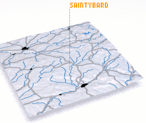 Places with similar names to Saint-Ybard, France ::
// Saint Aubert (US)
// Santa Berta (NI)
// Saint-Aybert (FR)
// Saint-Bard (FR)
// Saint-Aubert (FR)
// Saint-Aubert (FR)
// Saint-Bard (FR)
Disclaimer :: Information on this page comes without warranty of any kind |
||
|
Where is Saint-Ybard? Elevation and coordinates ::
Latitude (lat): 45°27'0"N Longitude (lon): 1°32'0"E
Elevation (approx.): 443m (map arrows pan, magnifying glasses zoom) |
||
|
Visiting Saint-Ybard? Hotel/Accommodation ::
Book a hotel in Saint-Ybard Travel Guide ::
Buy a travel guide for France rental cars ::
car rental offers GPS waypoint ::
download a GPX waypoint (PoI) of Saint-Ybard for your GPS receiver
|
||