|
search place name
|
||
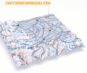
Santa-Maria-Maddalena (Provence-Alpes-Côte dʼAzur, France)Santa-Maria-Maddalena is a town in the Provence-Alpes-Côte dʼAzur region of France. An overview map of the region around Santa-Maria-Maddalena is displayed below.
regional and 3d topo map of Santa-Maria-Maddalena, France ::

Santa-Maria-Maddalena airports ::
The nearest airport is ALL - Albenga, located 50.6 km east of Santa-Maria-Maddalena.
Other airports nearby include CUF - Levaldigi (50.6 km north), NCE - Nice Cote D Azur (54.1 km south west), CEQ - Cannes Mandelieu (76.0 km south west), GOA - Genoa Genova Sestri (112.3 km east), Nearby towns ::
 Places with similar names to Santa-Maria-Maddalena, France ::
Disclaimer :: Information on this page comes without warranty of any kind |
||
|
Where is Santa-Maria-Maddalena? Elevation and coordinates ::
Latitude (lat): 44°6'0"N Longitude (lon): 7°30'0"E
Elevation (approx.): 1686m (map arrows pan, magnifying glasses zoom) |
||
|
Visiting Santa-Maria-Maddalena? Hotel/Accommodation ::
Book a hotel in Santa-Maria-Maddalena Travel Guide ::
Buy a travel guide for France rental cars ::
car rental offers GPS waypoint ::
download a GPX waypoint (PoI) of Santa-Maria-Maddalena for your GPS receiver
|
||