|
search place name
|
||
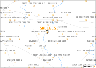
Saulges (Pays de la Loire, France)Saulges is a town in the Pays de la Loire region of France. An overview map of the region around Saulges is displayed below.
regional and 3d topo map of Saulges, France ::
Saulges airports ::
The nearest airport is LVA - Laval Entrammes, located 26.1 km west of Saulges.
Other airports nearby include LME - Le Mans Arnage (45.1 km east), RNS - Rennes St Jacques (100.0 km west), TUF - Tours Val De Loire (104.5 km south east), CET - Cholet Le Pontreau (106.4 km south), Nearby towns ::
Chéméré-le-Roi (2.5km west) //
Saint-Pierre-sur-Erve (3.7km north) //
Thorigné-en-Charnie (3.1km north east) //
Épineux-le-Séguin (4.5km south east) //
Bannes (3.7km east) //
Ballée (5.7km south) //
Saint-Jean-sur-Erve (5.7km north) //
Gilliers (5.3km south west) //
La Mahottière (6.1km north east) //
Cossé-en-Champagne (5.3km east) //
Moncor (7.5km north) //
Les Guetteries (7.8km north) //
Préaux (7.5km south west) //
Vaiges (8.9km north west) //
Blandouet (8.9km north east) //
[all distances 'as the bird flies' and approximate] 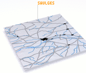 Places with similar names to Saulges, France ::
Disclaimer :: Information on this page comes without warranty of any kind |
||
|
Where is Saulges? Elevation and coordinates ::
Latitude (lat): 47°59'0"N Longitude (lon): 0°24'0"W
Elevation (approx.): 85m (map arrows pan, magnifying glasses zoom) |
||
|
Visiting Saulges? Hotel/Accommodation ::
Book a hotel in Saulges Travel Guide ::
Buy a travel guide for France rental cars ::
car rental offers GPS waypoint ::
download a GPX waypoint (PoI) of Saulges for your GPS receiver
|
||