|
search place name
|
||
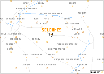
Selommes (Centre, France)Selommes is a town in the Centre region of France. An overview map of the region around Selommes is displayed below.
regional and 3d topo map of Selommes, France ::
Selommes airports ::
The nearest airport is ORE - Orleans Bricy, located 49.6 km north east of Selommes.
Other airports nearby include TUF - Tours Val De Loire (50.1 km south west), LME - Le Mans Arnage (77.9 km west), CHR - Chateauroux Deols (106.5 km south), BOU - Bourges (117.1 km south east), Nearby towns ::
Villemardy (2.2km south west) //
Villetrun (4.5km north west) //
Villefrancoeur (5.7km south) //
Faye (5.7km north) //
Périgny (4.2km south west) //
Villeromain (4.2km south west) //
Champigny-en-Beauce (5.3km south east) //
Baigneaux (5.3km north east) //
Le Breuil (7.4km south) //
La Chapelle-Enchérie (7.4km north) //
Rhodon (5.0km east) //
Épiais (6.7km north east) //
Rocé (6.7km north west) //
Coulommiers-la-Tour (6.2km north west) //
Sainte-Gemmes (6.2km north east) //
Tourailles (8.3km south west) //
[all distances 'as the bird flies' and approximate]  Places with similar names to Selommes, France ::
// Zela Āmbesa (ER)
// Zell am Moos (AT)
// Zell am See (AT)
// Solms (DE)
// Salamís (GR)
// Solomós (GR)
// Salemas (PT)
// Selmes (PT)
// Sulmice (PL)
// Złe Mięso (PL)
Disclaimer :: Information on this page comes without warranty of any kind |
||
|
Where is Selommes? Elevation and coordinates ::
Latitude (lat): 47°45'0"N Longitude (lon): 1°12'0"E
Elevation (approx.): 122m (map arrows pan, magnifying glasses zoom) |
||
|
Visiting Selommes? Hotel/Accommodation ::
Book a hotel in Selommes Travel Guide ::
Buy a travel guide for France rental cars ::
car rental offers GPS waypoint ::
download a GPX waypoint (PoI) of Selommes for your GPS receiver
|
||