|
search place name
|
||
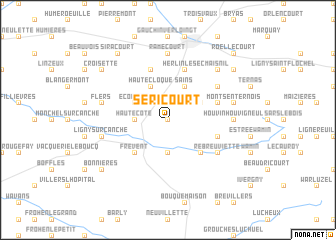
Séricourt (Nord-Pas-de-Calais, France)Séricourt is a town in the Nord-Pas-de-Calais region of France. An overview map of the region around Séricourt is displayed below.
regional and 3d topo map of Séricourt, France ::
Séricourt airports ::
The nearest airport is LTQ - Le Tourquet Le Touquet Paris Plage, located 55.1 km north west of Séricourt.
Other airports nearby include LIL - Lille Lesquin (62.2 km north east), CQF - Calais Dunkerque (78.0 km north), QKT - Kortrijk-vevelgem Wevelgem (85.3 km north east), BVA - Beauvais Tille (95.2 km south), Nearby towns ::
Sibiville (0.0km north) //
Grand Bouret (3.7km south) //
Hautecôte (2.4km west) //
Nuncq (2.4km west) //
Sains (3.9km north) //
Buneville (3.0km north east) //
Framecourt (3.9km north) //
Hautecloque (3.9km north) //
Écoivres (3.0km north west) //
Rebreuve-sur-Canche (4.4km south east) //
Frévent (4.4km south west) //
Herlin-le-Sec (5.7km north) //
Canettemont (4.0km south east) //
Moncheaux (4.0km north east) //
Herlincourt (5.7km north) //
Rébreuviette (5.1km south east) //
Neuville-au-Cornet (5.1km north east) //
Houvin-Houvigneul (4.7km east) //
Ramecourt (7.4km north) //
Monts-en-Ternois (5.1km east) //
Ligny-sur-Canche (5.1km west) //
Flers (5.1km west) //
Maisnil (6.6km north east) //
Foufflin-Ricametz (7.3km north east) //
Bonnières (7.3km south west) //
Héricourt (7.3km north west) //
Croisette (7.3km north west) //
Siracourt (8.2km north west) //
Roëllecourt (8.8km north east) //
[all distances 'as the bird flies' and approximate]  Places with similar names to Séricourt, France ::
// Cerrogordo (US)
// Cerrogordo (US)
// Cerro Gordo (US)
// Cerro Corotú (PA)
// Cerro Gordo (PA)
// Cerro Gordo (PA)
// Cerro Gordo (PA)
// Cerro Gordo (PA)
// Surcurtí (PA)
// Surcurtí (PA)
Disclaimer :: Information on this page comes without warranty of any kind |
||
|
Where is Séricourt? Elevation and coordinates ::
Latitude (lat): 50°18'0"N Longitude (lon): 2°19'0"E
Elevation (approx.): 127m (map arrows pan, magnifying glasses zoom) |
||
|
Visiting Séricourt? Hotel/Accommodation ::
Book a hotel in Séricourt Travel Guide ::
Buy a travel guide for France rental cars ::
car rental offers GPS waypoint ::
download a GPX waypoint (PoI) of Séricourt for your GPS receiver
|
||