|
search place name
|
||
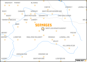
Sermages (Bourgogne, France)Sermages is a town in the Bourgogne region of France. An overview map of the region around Sermages is displayed below.
regional and 3d topo map of Sermages, France ::
Sermages airports ::
The nearest airport is NVS - Nevers Fourchambault, located 56.0 km west of Sermages.
Other airports nearby include XMU - Moulins Montbeugny (62.7 km south west), XCD - Chalon Champforgeuil (76.7 km east), AUF - Auxerre Branches (96.4 km north), DIJ - Dijon Longvic (98.1 km east), Nearby towns ::
Les Chaumes (1.3km west) //
Grand-Ry (1.9km south) //
Champy (4.5km north west) //
Poiseux (4.5km south east) //
Moulins-Engilbert (4.5km south west) //
Dommartin (5.6km north) //
Saint-Léger-de-Fougeret (3.8km east) //
Saint-Péreuse (6.7km north west) //
Onlay (6.7km south east) //
Saint-Hilaire-en-Morvan (7.8km north) //
Grandry (7.8km north) //
Maux (6.3km north west) //
Dun-sur-Grandry (8.3km north west) //
[all distances 'as the bird flies' and approximate] 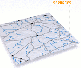 Places with similar names to Sermages, France :: Disclaimer :: Information on this page comes without warranty of any kind |
||
|
Where is Sermages? Elevation and coordinates ::
Latitude (lat): 47°1'0"N Longitude (lon): 3°51'0"E
Elevation (approx.): 293m (map arrows pan, magnifying glasses zoom) |
||
|
Visiting Sermages? Hotel/Accommodation ::
Book a hotel in Sermages Travel Guide ::
Buy a travel guide for France rental cars ::
car rental offers GPS waypoint ::
download a GPX waypoint (PoI) of Sermages for your GPS receiver
|
||