|
search place name
|
||
Sévigny-Waleppe (Champagne-Ardenne, France)Sévigny-Waleppe is a town in the Champagne-Ardenne region of France. An overview map of the region around Sévigny-Waleppe is displayed below.
regional and 3d topo map of Sévigny-Waleppe, France ::

Sévigny-Waleppe airports ::
The nearest airport is RHE - Reims Champagne, located 32.3 km south of Sévigny-Waleppe.
Other airports nearby include CRL - Charleroi Brussels South (99.5 km north), CSF - Creil (118.7 km west), LIL - Lille Lesquin (127.8 km north west), CDG - Paris Charles De Gaulle (128.2 km south west), Nearby towns ::
Saint-Quentin-le-Petit (2.2km south east) //
Nizy-le-Comte (3.9km south) //
Dizy-le-Gros (5.2km north west) //
Banogne-Recouvrance (5.2km south east) //
Hannogne-Saint-Rémy (4.8km east) //
Montloué (7.4km north) //
Le Thour (7.5km south) //
Lor (7.5km south) //
Renneville (6.6km north east) //
Noircourt (7.8km north) //
La Selve (6.1km south west) //
Berlise (8.2km north east) //
La Ville-aux-Bois-lès-Dizy (8.8km north west) //
[all distances 'as the bird flies' and approximate] 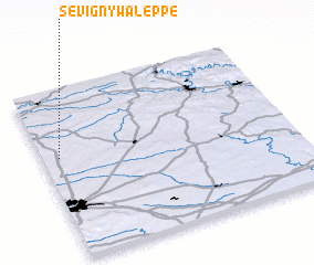 Places with similar names to Sévigny-Waleppe, France :: Disclaimer :: Information on this page comes without warranty of any kind |
||
|
Where is Sévigny-Waleppe? Elevation and coordinates ::
Latitude (lat): 49°36'0"N Longitude (lon): 4°4'0"E
Elevation (approx.): 111m (map arrows pan, magnifying glasses zoom) |
||
|
Visiting Sévigny-Waleppe? Hotel/Accommodation ::
Book a hotel in Sévigny-Waleppe Travel Guide ::
Buy a travel guide for France rental cars ::
car rental offers GPS waypoint ::
download a GPX waypoint (PoI) of Sévigny-Waleppe for your GPS receiver
|
||