|
search place name
|
||
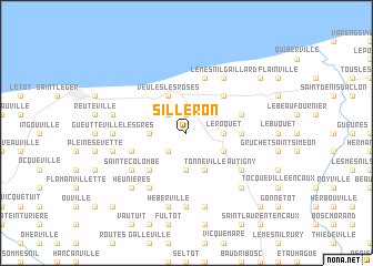
Silleron (Haute-Normandie, France)Silleron is a town in the Haute-Normandie region of France. An overview map of the region around Silleron is displayed below.
regional and 3d topo map of Silleron, France ::
Silleron airports ::
The nearest airport is URO - Rouen Vallee De Seine, located 56.3 km south east of Silleron.
Other airports nearby include LEH - Le Havre Octeville (62.2 km south west), DOL - Deauville St Gatien (70.7 km south west), LTQ - Le Tourquet Le Touquet Paris Plage (95.3 km north east), BVA - Beauvais Tille (102.7 km south east), Nearby towns ::
Iclon (1.9km north) //
Houdetot (2.2km south west) //
Blosseville (2.2km north west) //
Le Roquet (2.4km east) //
Bourville (3.7km south) //
Angiens (2.4km west) //
Saint-Pierre-le-Viger (3.0km south east) //
Fontaine-le-Dun (3.0km south east) //
Tonneville (3.9km south) //
Veules-les-Roses (3.9km north) //
Ermenouville (4.4km south west) //
La Chapelle-sur-Dun (4.4km north east) //
La Gaillarde (3.6km east) //
Sotteville-sur-Mer (5.7km north) //
Le Mesnil-Durdent (4.0km south west) //
Saint-Pierre-le-Vieux (4.0km north east) //
Le Mesnil Gaillard (6.1km north east) //
Sainte-Colombe (5.2km south west) //
Autigny (5.2km south east) //
Crasville-la-Rocquefort (5.2km south east) //
Anglesqueville-la-Bras-Long (6.1km south west) //
Gonzeville (7.4km south) //
Gueutteville-les-Grès (4.8km west) //
Canville-les-Deux-Églises (7.5km south) //
Héberville (7.5km south) //
Pleine-Sève (5.1km west) //
Manneville-ès-Plains (5.1km west) //
Heunières (6.6km south west) //
Brametot (6.6km south east) //
[all distances 'as the bird flies' and approximate] 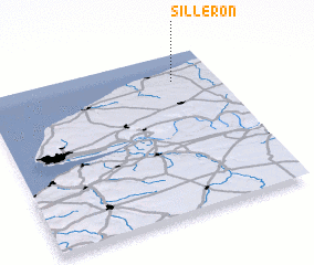 Places with similar names to Silleron, France ::
Disclaimer :: Information on this page comes without warranty of any kind |
||
|
Where is Silleron? Elevation and coordinates ::
Latitude (lat): 49°50'0"N Longitude (lon): 0°49'0"W
Elevation (approx.): 70m (map arrows pan, magnifying glasses zoom) |
||
|
Visiting Silleron? Hotel/Accommodation ::
Book a hotel in Silleron Travel Guide ::
Buy a travel guide for France rental cars ::
car rental offers GPS waypoint ::
download a GPX waypoint (PoI) of Silleron for your GPS receiver
|
||