|
search place name
|
||
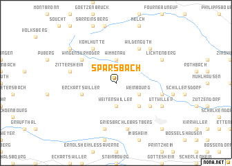
Sparsbach (Alsace, France)Sparsbach is a town in the Alsace region of France. An overview map of the region around Sparsbach is displayed below.
regional and 3d topo map of Sparsbach, France ::
Sparsbach airports ::
The nearest airport is SXB - Strassbourg Entzheim, located 41.4 km south of Sparsbach.
Other airports nearby include SCN - Saarbruecken Saarbrucken (43.1 km north west), ZCC - Baden-baden Baden Oos (57.5 km east), RMS - Ramstein Ab (63.0 km north), ETZ - Metz Nancy Lorraine (86.1 km west), Nearby towns ::
Weiterswiller (3.7km south) //
Wimmenau (3.7km north) //
Weinbourg (3.1km south east) //
Obersoultzbach (4.4km south east) //
Erckartswiller (4.1km south west) //
Niedersoultzbach (5.2km south east) //
Wildenguth (6.1km north east) //
Wingen-sur-Moder (5.2km north west) //
Kohlhutte (6.1km north west) //
Griesbach-le-Bastberg (7.5km south) //
Ingwiller (5.2km east) //
Neuwiller-lès-Saverne (7.5km south) //
Zittersheim (5.2km west) //
Reipertswiller (6.7km north east) //
Uttwiller (6.1km south east) //
Lichtenberg (6.1km north east) //
Rosteig (7.4km north west) //
Bouxwiller (8.9km south east) //
Riedheim (8.9km south east) //
[all distances 'as the bird flies' and approximate] 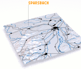 Places with similar names to Sparsbach, France ::
// Suppersbach (AT)
Disclaimer :: Information on this page comes without warranty of any kind |
||
|
Where is Sparsbach? Elevation and coordinates ::
Latitude (lat): 48°53'0"N Longitude (lon): 7°25'0"E
Elevation (approx.): 258m (map arrows pan, magnifying glasses zoom) |
||
|
Visiting Sparsbach? Hotel/Accommodation ::
Book a hotel in Sparsbach Travel Guide ::
Buy a travel guide for France rental cars ::
car rental offers GPS waypoint ::
download a GPX waypoint (PoI) of Sparsbach for your GPS receiver
|
||