|
search place name
|
||
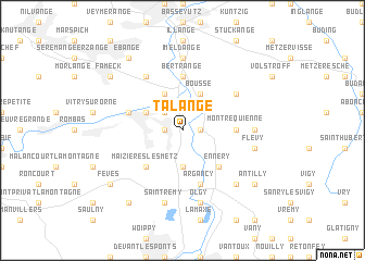
Talange (Lorraine, France)Talange is a town in the Lorraine region of France. An overview map of the region around Talange is displayed below.
regional and 3d topo map of Talange, France ::
Talange airports ::
The nearest airport is MZM - Metz Frescaty, located 20.2 km south of Talange.
Other airports nearby include ETZ - Metz Nancy Lorraine (30.2 km south), LUX - Luxemburg Luxembourg (41.9 km north), ENC - Nancy Essey (62.1 km south), SCN - Saarbruecken Saarbrucken (67.6 km east), Nearby towns ::
Hagondange (1.2km west) //
Ay-sur-Moselle (1.2km east) //
Mondelange (2.2km north west) //
Hauconcourt (3.7km south) //
Richemont (3.9km north) //
Amnéville (3.0km north west) //
Bousse (3.9km north) //
Maizières-lès-Metz (4.4km south west) //
Ennery (4.4km south east) //
Bertrange (5.6km north) //
Guénange (5.6km north) //
Montrequienne (3.6km east) //
Argancy (5.7km south) //
Gandrange (4.1km north west) //
Uckange (6.1km north west) //
Rurange-lès-Thionville (5.2km north east) //
Imeldange (7.4km north) //
Trémery (4.8km east) //
Saint-Rémy (7.5km south) //
Malroy (7.5km south) //
Olgy (7.5km south) //
Flévy (5.2km east) //
Chailly-lès-Ennery (6.6km south east) //
Fameck (7.4km north west) //
Fèves (7.4km south west) //
Antilly (7.4km south east) //
Ébange (8.3km north west) //
Semécourt (8.3km south west) //
[all distances 'as the bird flies' and approximate] 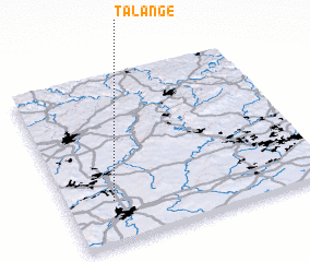 Places with similar names to Talange, France ::
Disclaimer :: Information on this page comes without warranty of any kind |
||
|
Where is Talange? Elevation and coordinates ::
Latitude (lat): 49°15'0"N Longitude (lon): 6°11'0"E
Elevation (approx.): 156m (map arrows pan, magnifying glasses zoom) |
||
|
Visiting Talange? Hotel/Accommodation ::
Book a hotel in Talange Travel Guide ::
Buy a travel guide for France rental cars ::
car rental offers GPS waypoint ::
download a GPX waypoint (PoI) of Talange for your GPS receiver
|
||