|
search place name
|
||
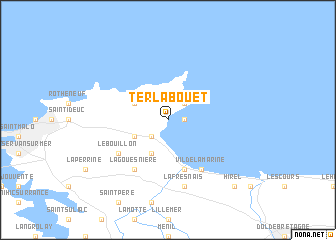
Terlabouet (Bretagne, France)Terlabouet is a town in the Bretagne region of France. An overview map of the region around Terlabouet is displayed below.
regional and 3d topo map of Terlabouet, France ::
Terlabouet airports ::
The nearest airport is DNR - Dinard Pleurtuit, located 18.0 km south west of Terlabouet.
Other airports nearby include JER - Jersey (64.8 km north), RNS - Rennes St Jacques (67.1 km south), SBK - St.-brieuc Armor Armor (74.2 km west), GCI - Guernsey (100.9 km north west), Nearby towns ::
La Houle (1.2km east) //
Cancale (2.2km north east) //
La Coudre (2.2km south west) //
Saint-Coulomb (3.1km north west) //
Saint-Méloir-des-Ondes (3.1km south west) //
Blessin (3.9km south) //
Saint-Benoît-des-Ondes (5.7km south) //
La Gouesnière (6.1km south west) //
Vildé la Marine (6.1km south east) //
Le Bouillon (5.2km south west) //
La Fresnais (7.5km south) //
Hirel (8.9km south east) //
[all distances 'as the bird flies' and approximate] 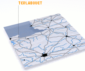 Places with similar names to Terlabouet, France ::
// Dar el Abiodh (MA)
// Dar el Beïda (TN)
// Douar el Abaïda (TN)
// Douar el Beïda (TN)
// Durllabhdi (BD)
// Dar el Abiat (MA)
// Douar el Biaïda (MA)
// Dar el Beïda (DZ)
// Dar el Beïda (DZ)
// Dar Loubit (DZ)
Disclaimer :: Information on this page comes without warranty of any kind |
||
|
Where is Terlabouet? Elevation and coordinates ::
Latitude (lat): 48°40'0"N Longitude (lon): 1°52'0"W
Elevation (approx.): 44m (map arrows pan, magnifying glasses zoom) |
||
|
Visiting Terlabouet? Hotel/Accommodation ::
Book a hotel in Terlabouet Travel Guide ::
Buy a travel guide for France rental cars ::
car rental offers GPS waypoint ::
download a GPX waypoint (PoI) of Terlabouet for your GPS receiver
|
||