|
search place name
|
||
Thièvres (Picardie, France)Thièvres is a town in the Picardie region of France. An overview map of the region around Thièvres is displayed below.
regional and 3d topo map of Thièvres, France ::

Thièvres airports ::
The nearest airport is LIL - Lille Lesquin, located 67.3 km north east of Thièvres.
Other airports nearby include LTQ - Le Tourquet Le Touquet Paris Plage (74.0 km north west), BVA - Beauvais Tille (77.6 km south), QKT - Kortrijk-vevelgem Wevelgem (94.6 km north east), CSF - Creil (96.1 km south), Nearby towns ::
Thièvres (1.9km north) //
Sarton (1.2km west) //
Famechon (2.2km north east) //
Marieux (2.2km south west) //
Orville (2.4km west) //
Vauchelles-lès-Authie (4.4km south east) //
Authie (3.6km east) //
Amplier (4.0km north west) //
Mondicourt (5.7km north) //
Pommera (5.7km north) //
Louvencourt (4.0km south east) //
Raincheval (5.7km south) //
Pas-en-Artois (5.1km north east) //
Halloy (6.0km north west) //
Arquèves (6.0km south east) //
Beauquesne (5.1km south west) //
Saint-Léger-lès-Authie (4.8km east) //
Warlincourt-lès-Pas (6.6km north east) //
Grincourt-lès-Pas (6.6km north east) //
Puchevillers (7.8km south) //
Léalvillers (7.3km south east) //
Grouches-Luchuel (8.8km north west) //
[all distances 'as the bird flies' and approximate] 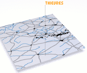
Disclaimer :: Information on this page comes without warranty of any kind |
||
|
Where is Thièvres? Elevation and coordinates ::
Latitude (lat): 50°7'0"N Longitude (lon): 2°27'0"E
Elevation (approx.): 126m (map arrows pan, magnifying glasses zoom) |
||
|
Visiting Thièvres? Hotel/Accommodation ::
Book a hotel in Thièvres Travel Guide ::
Buy a travel guide for France rental cars ::
car rental offers GPS waypoint ::
download a GPX waypoint (PoI) of Thièvres for your GPS receiver
|
||