|
search place name
|
||
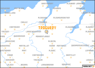
Troguéry (Bretagne, France)Troguéry is a town in the Bretagne region of France. An overview map of the region around Troguéry is displayed below.
regional and 3d topo map of Troguéry, France ::
Troguéry airports ::
The nearest airport is LAI - Lannion, located 18.8 km west of Troguéry.
Other airports nearby include SBK - St.-brieuc Armor Armor (35.6 km south east), MXN - Morlaix Ploujean (47.0 km west), DNR - Dinard Pleurtuit (85.6 km east), GCI - Guernsey (88.4 km north east), Nearby towns ::
Hengoat (1.2km east) //
Pommerit-Jaudy (2.2km south west) //
Pouldouran (2.2km north east) //
Tréguier (3.9km north) //
Minihy-Tréguier (3.9km north) //
Ploëzal (3.9km south) //
Trédarzec (3.9km north) //
La Roche-Derrien (3.7km west) //
Plouguiel (5.7km north) //
Runan (5.7km south) //
Langoat (4.9km west) //
Plouëc (7.5km south) //
Pontrieux (6.7km south east) //
Pleumeur-Gautier (6.7km north east) //
[all distances 'as the bird flies' and approximate] 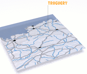 Places with similar names to Troguéry, France ::
// Toracari (BO)
// Tríkeri (GR)
// Törökér (HU)
// Torreagüera (ES)
// Traiguera (ES)
// Taurikura (NZ)
// Traquair (NZ)
// Dar-e Gūrū (IR)
// Dar-e Kerū (IR)
// Dar Gūr (IR)
Disclaimer :: Information on this page comes without warranty of any kind |
||
|
Where is Troguéry? Elevation and coordinates ::
Latitude (lat): 48°45'0"N Longitude (lon): 3°13'0"W
Elevation (approx.): 46m (map arrows pan, magnifying glasses zoom) |
||
|
Visiting Troguéry? Hotel/Accommodation ::
Book a hotel in Troguéry Travel Guide ::
Buy a travel guide for France rental cars ::
car rental offers GPS waypoint ::
download a GPX waypoint (PoI) of Troguéry for your GPS receiver
|
||