|
search place name
|
||
Urvillers (Picardie, France)Urvillers is a town in the Picardie region of France. An overview map of the region around Urvillers is displayed below.
regional and 3d topo map of Urvillers, France ::

Urvillers airports ::
The nearest airport is RHE - Reims Champagne, located 74.8 km south east of Urvillers.
Other airports nearby include CSF - Creil (82.5 km south west), LIL - Lille Lesquin (88.1 km north), BVA - Beauvais Tille (94.4 km west), CDG - Paris Charles De Gaulle (102.2 km south west), Nearby towns ::
Benay (3.7km south) //
Cerizy (3.9km south) //
Itancourt (3.0km north east) //
Neuville-Saint-Amand (3.9km north) //
Essigny-le-Grand (3.0km south west) //
Harly (5.6km north) //
Grugies (4.0km north west) //
Mesnil-Saint-Laurent (6.1km north east) //
Hamégicourt (5.2km south east) //
Alaincourt (5.2km south east) //
Moy-de-lʼAisne (5.2km south east) //
Gauchy (5.2km north west) //
Gibercourt (6.1km south west) //
Hinacourt (6.1km south west) //
Rouvroy (7.4km north) //
Berthenicourt (5.1km east) //
Ly-Fontaine (7.5km south) //
Vendeuil (7.8km south) //
Remigny (7.8km south) //
Saint-Quentin (7.8km north) //
Brissay-Choigny (8.2km south east) //
Homblières (8.2km north east) //
Montescourt-Lizerolles (7.3km south west) //
[all distances 'as the bird flies' and approximate] 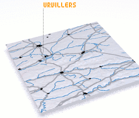 Places with similar names to Urvillers, France :: Disclaimer :: Information on this page comes without warranty of any kind |
||
|
Where is Urvillers? Elevation and coordinates ::
Latitude (lat): 49°47'0"N Longitude (lon): 3°19'0"E
Elevation (approx.): 105m (map arrows pan, magnifying glasses zoom) |
||
|
Visiting Urvillers? Hotel/Accommodation ::
Book a hotel in Urvillers Travel Guide ::
Buy a travel guide for France rental cars ::
car rental offers GPS waypoint ::
download a GPX waypoint (PoI) of Urvillers for your GPS receiver
|
||