|
search place name
|
||
Vallesvilles (Midi-Pyrénées, France)Vallesvilles is a town in the Midi-Pyrénées region of France. An overview map of the region around Vallesvilles is displayed below.
regional and 3d topo map of Vallesvilles, France ::

Vallesvilles airports ::
The nearest airport is TLS - Toulouse Blagnac, located 22.0 km west of Vallesvilles.
Other airports nearby include LRH - La Rochelle Lherm (34.3 km south west), LBI - Albi Le Sequestre (52.0 km north east), DCM - Castres Mazamet (53.2 km east), CCF - Carcassonne Salvaza (69.2 km south east), Nearby towns ::
Gauré (2.3km north west) //
Drémil-Lafage (2.7km west) //
Saint-Pierre-de-Lages (3.9km south) //
Saint-Pierre (3.9km north) //
Lavalette (4.6km north west) //
Aigrefeuille (4.6km south west) //
Lanta (4.6km south east) //
Sainte-Foy-dʼAigrefeuille (5.7km south) //
Champs (5.7km north) //
Mons (4.4km north west) //
Flourens (5.4km west) //
Quint (5.7km west) //
Mondouzil (6.5km north west) //
Teulat (6.5km north east) //
Saint-Marcel-Paulel (7.9km north) //
Verfeil (7.9km north) //
Aurin (7.9km south) //
Lauzerville (7.7km south west) //
Auzielle (7.7km south west) //
[all distances 'as the bird flies' and approximate] 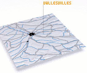 Places with similar names to Vallesvilles, France :: Disclaimer :: Information on this page comes without warranty of any kind |
||
|
Where is Vallesvilles? Elevation and coordinates ::
Latitude (lat): 43°36'0"N Longitude (lon): 1°38'0"E
Elevation (approx.): 237m (map arrows pan, magnifying glasses zoom) |
||
|
Visiting Vallesvilles? Hotel/Accommodation ::
Book a hotel in Vallesvilles Travel Guide ::
Buy a travel guide for France rental cars ::
car rental offers GPS waypoint ::
download a GPX waypoint (PoI) of Vallesvilles for your GPS receiver
|
||