|
search place name
|
||
Vémars (France)Vémars is a town in France. An overview map of the region around Vémars is displayed below.
regional and 3d topo map of Vémars, France ::

nearby GPS traces from timatio ::
Vémars airports ::
The nearest airport is CDG - Paris Charles De Gaulle, located 6.1 km south of Vémars.
Other airports nearby include LBG - Paris Le Bourget (14.2 km south west), CSF - Creil (21.1 km north), POX - Pontoise Cormeilles En Vexin (38.6 km west), ORY - Paris Orly (40.9 km south), Nearby towns ::
Saint-Witz (1.9km north) //
Chennevières-lès-Louvres (2.2km south west) //
Moussy-le-Neuf (2.4km east) //
Plailly (3.9km north) //
Survilliers (3.9km north) //
Mauregard (3.9km south) //
Épiais-lès-Louvres (3.9km south) //
Villeron (3.1km south west) //
Moussy-le-Vieux (4.1km south east) //
Le Mesnil-Amelot (6.1km south east) //
Mortefontaine (6.1km north east) //
Marly-la-Ville (5.2km west) //
La Chapelle-en-Serval (7.8km north) //
Villeneuve-sous-Dammartin (6.1km south east) //
Louvres (6.1km south west) //
Orry-la-Ville (8.3km north west) //
Roissy-en-France (8.3km south west) //
[all distances 'as the bird flies' and approximate] 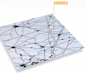 Places with similar names to Vémars, France ::
// Phumĭ Rœssei (KH)
// Phumĭ Rœssei (KH)
// Phumĭ Rœssei (KH)
// Phumĭ Rœssei (KH)
// Famars (FR)
// Vimarcé (FR)
// Vomarz (AF)
// Fomorosso (CI)
Disclaimer :: Information on this page comes without warranty of any kind |
||
|
Where is Vémars? Elevation and coordinates ::
Latitude (lat): 49°4'0"N Longitude (lon): 2°34'0"E
Elevation (approx.): 126m (map arrows pan, magnifying glasses zoom) |
||
|
Visiting Vémars? Hotel/Accommodation ::
Book a hotel in Vémars Travel Guide ::
Buy a travel guide for France rental cars ::
car rental offers GPS waypoint ::
download a GPX waypoint (PoI) of Vémars for your GPS receiver
|
||