|
search place name
|
||
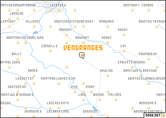
Vendranges (Rhône-Alpes, France)Vendranges is a town in the Rhône-Alpes region of France. An overview map of the region around Vendranges is displayed below.
regional and 3d topo map of Vendranges, France ::
Vendranges airports ::
The nearest airport is RNE - Roanne Renaison, located 17.2 km north west of Vendranges.
Other airports nearby include XVF - Vilefrance Tarare (39.1 km east), EBU - St.-etienne Boutheon (45.5 km south), VHY - Vichy Charmeil (62.3 km north west), QNX - Macon Charnay (65.1 km north east), Nearby towns ::
LʼHôpital-sous-Rochefort (3.7km north) //
Bournat (3.7km north) //
Saint-Priest-la-Roche (3.2km south west) //
Saint-Cyr-de-Favières (4.5km north west) //
Saint-Jodard (5.6km south) //
Parigny (6.1km north west) //
Neulise (5.4km south east) //
Neaux (5.4km north east) //
Chezeau (7.4km south) //
Notre-Dame-de-Boisset (7.4km north) //
Rive (7.5km south) //
Pinay (7.5km south) //
Cordelle (5.5km west) //
Saint-Vincent-de-Boisset (7.5km north) //
Saint-Paul-de-Vézelin (6.8km south west) //
Saint-Marcel-de-Félines (8.4km south east) //
Pradines (8.4km north east) //
Commelle-Vernay (9.0km north west) //
[all distances 'as the bird flies' and approximate] 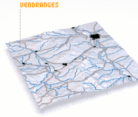 Places with similar names to Vendranges, France :: Disclaimer :: Information on this page comes without warranty of any kind |
||
|
Where is Vendranges? Elevation and coordinates ::
Latitude (lat): 45°56'0"N Longitude (lon): 4°8'0"E
Elevation (approx.): 511m (map arrows pan, magnifying glasses zoom) |
||
|
Visiting Vendranges? Hotel/Accommodation ::
Book a hotel in Vendranges Travel Guide ::
Buy a travel guide for France rental cars ::
car rental offers GPS waypoint ::
download a GPX waypoint (PoI) of Vendranges for your GPS receiver
|
||