|
search place name
|
||
Véraza (Languedoc-Roussillon, France)Véraza is a town in the Languedoc-Roussillon region of France. An overview map of the region around Véraza is displayed below.
regional and 3d topo map of Véraza, France ::

Véraza airports ::
The nearest airport is CCF - Carcassonne Salvaza, located 25.9 km north of Véraza.
Other airports nearby include PGF - Perpignan Rivesaltes (53.9 km south east), DCM - Castres Mazamet (63.7 km north), BZR - Beziers Vias (93.7 km north east), LRH - La Rochelle Lherm (98.8 km north west), Nearby towns ::
Peyrolles (2.3km south east) //
Cassaignes (3.7km south) //
Terrolles (2.7km east) //
Luc-sur-Aude (3.3km south west) //
Coustaussa (3.9km south) //
Serres (3.9km south) //
Alet-les-Bains (3.3km north west) //
Vendémies (3.9km north) //
Saint-Polycarpe (5.6km north) //
Montazels (5.5km south west) //
Couiza (5.5km south west) //
Rennes-le-Château (6.2km south west) //
Valmigère (5.4km east) //
Rennes-les-Bains (7.5km south) //
Missègre (5.7km east) //
Cournanel (6.9km north west) //
Antugnac (6.6km south west) //
Belcastel-et-Buc (7.8km north east) //
[all distances 'as the bird flies' and approximate] 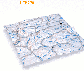 Places with similar names to Véraza, France ::
Disclaimer :: Information on this page comes without warranty of any kind |
||
|
Where is Véraza? Elevation and coordinates ::
Latitude (lat): 42°59'0"N Longitude (lon): 2°18'0"E
Elevation (approx.): 412m (map arrows pan, magnifying glasses zoom) |
||
|
Visiting Véraza? Hotel/Accommodation ::
Book a hotel in Véraza Travel Guide ::
Buy a travel guide for France rental cars ::
car rental offers GPS waypoint ::
download a GPX waypoint (PoI) of Véraza for your GPS receiver
|
||