|
search place name
|
||
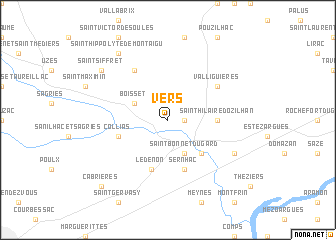
Vers (Languedoc-Roussillon, France)Vers is a town in the Languedoc-Roussillon region of France. An overview map of the region around Vers is displayed below.
regional and 3d topo map of Vers, France ::
Vers airports ::
The nearest airport is FNI - Nimes Garons, located 25.1 km south of Vers.
Other airports nearby include AVN - Avignon Caumont (30.3 km east), MPL - Montpellier Mediterranee (63.2 km south west), OBS - Aubenas-vals-lanas Ardeche Meridionale (65.5 km north), MRS - Marseille Provence (80.6 km south east), Nearby towns ::
Castillon-du-Gard (1.3km east) //
Argilliers (3.2km north west) //
Boisset (3.2km north west) //
Saint-Bonnet-du-Gard (3.9km south) //
Remoulins (4.6km south east) //
Saint-Hilaire-dʼOzilhan (4.0km east) //
Lédenon (5.7km south) //
Sernhac (5.7km south) //
Collias (4.4km south west) //
Valliguières (5.5km north east) //
Flaux (6.2km north west) //
Fournès (6.5km south east) //
Saint-Siffret (7.7km north west) //
Saint-Hippolyte-de-Montaigu (8.4km north west) //
Cabrières (9.1km south west) //
[all distances 'as the bird flies' and approximate] 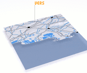 Places with similar names to Vers, France ::
Disclaimer :: Information on this page comes without warranty of any kind |
||
|
Where is Vers? Elevation and coordinates ::
Latitude (lat): 43°58'0"N Longitude (lon): 4°32'0"E
Elevation (approx.): 71m (map arrows pan, magnifying glasses zoom) |
||
|
Visiting Vers? Hotel/Accommodation ::
Book a hotel in Vers Travel Guide ::
Buy a travel guide for France rental cars ::
car rental offers GPS waypoint ::
download a GPX waypoint (PoI) of Vers for your GPS receiver
|
||