|
search place name
|
||
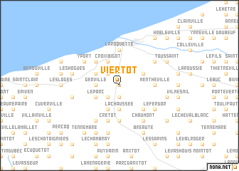
Viertot (Haute-Normandie, France)Viertot is a town in the Haute-Normandie region of France. An overview map of the region around Viertot is displayed below.
regional and 3d topo map of Viertot, France ::
Viertot airports ::
The nearest airport is LEH - Le Havre Octeville, located 27.3 km south west of Viertot.
Other airports nearby include DOL - Deauville St Gatien (40.3 km south), URO - Rouen Vallee De Seine (68.2 km south east), CFR - Caen Carpiquet (83.3 km south west), LTQ - Le Tourquet Le Touquet Paris Plage (127.7 km north east), Nearby towns ::
Épreville (0.0km north) //
Auberville-la-Renault (1.9km south) //
Les Marquets (2.2km north west) //
La Couarde (2.2km south west) //
La Chaussée (3.7km south) //
Maniquerville (2.4km west) //
Gerville (2.4km west) //
Croix Bigot (3.9km north) //
Beau Soleil (3.0km north east) //
Tourville-les-Ifs (3.0km north east) //
Sausseuzemare-en-Caux (3.9km south) //
Froberville (3.0km north west) //
Le Parc (3.0km south west) //
Bretteville-du-Grand Caux (4.4km south east) //
Criquebeuf-en-Caux (4.4km north west) //
Fécamp (5.6km north) //
Saint-Léonard (5.6km north) //
La Roquette (5.6km north) //
Mentheville (3.6km east) //
Goderville (5.6km south) //
Cretot (5.7km south) //
Ganzeville (5.2km north east) //
Yport (5.2km north west) //
Le Fer dʼOr (5.2km south east) //
Grainville-Ymauville (5.2km south east) //
Chaumont (6.1km south east) //
Écrainville (6.1km south west) //
Annouville-Vilmesnil (5.1km east) //
Les Hogues (5.1km west) //
[all distances 'as the bird flies' and approximate]  Places with similar names to Viertot, France ::
Disclaimer :: Information on this page comes without warranty of any kind |
||
|
Where is Viertot? Elevation and coordinates ::
Latitude (lat): 49°42'0"N Longitude (lon): 0°22'0"W
Elevation (approx.): 112m (map arrows pan, magnifying glasses zoom) |
||
|
Visiting Viertot? Hotel/Accommodation ::
Book a hotel in Viertot Travel Guide ::
Buy a travel guide for France rental cars ::
car rental offers GPS waypoint ::
download a GPX waypoint (PoI) of Viertot for your GPS receiver
|
||