|
search place name
|
||
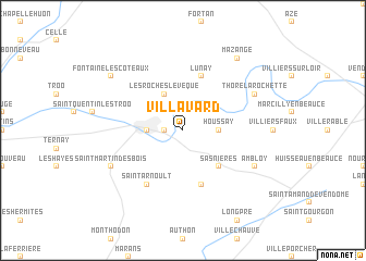
Villavard (Centre, France)Villavard is a town in the Centre region of France. An overview map of the region around Villavard is displayed below.
regional and 3d topo map of Villavard, France ::
Villavard airports ::
The nearest airport is TUF - Tours Val De Loire, located 37.6 km south of Villavard.
Other airports nearby include LME - Le Mans Arnage (56.7 km north west), ORE - Orleans Bricy (69.6 km north east), CHR - Chateauroux Deols (117.0 km south east), LVA - Laval Entrammes (126.8 km west), Nearby towns ::
Lavardin (1.2km west) //
Saint-Rimay (2.2km north east) //
Houssay (2.5km east) //
Montoire-sur-le-Loir (2.5km west) //
Les Roches-lʼÉvêque (3.9km north) //
Sasnières (4.5km south east) //
Lunay (5.7km north) //
Prunay-Cassereau (5.7km south) //
Saint-Arnoult (6.1km south west) //
Thoré-la-Rochette (6.2km north east) //
Saint-Martin-des-Bois (6.2km south west) //
Ambloy (6.2km south east) //
Fontaine-les-Côteaux (7.5km north west) //
Mazangé (8.3km north east) //
[all distances 'as the bird flies' and approximate] 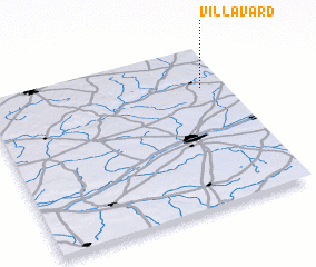 Places with similar names to Villavard, France ::
// Vallefuerte (BO)
// Val Verde (US)
// Val Verde (US)
// Valley Ford (US)
// Fulford (US)
// Vale Farto (PT)
// Vale Verde (PT)
// Valverda (PT)
// Valverde (PT)
// Valverde (PT)
Disclaimer :: Information on this page comes without warranty of any kind |
||
|
Where is Villavard? Elevation and coordinates ::
Latitude (lat): 47°45'0"N Longitude (lon): 0°54'0"W
Elevation (approx.): 126m (map arrows pan, magnifying glasses zoom) |
||
|
Visiting Villavard? Hotel/Accommodation ::
Book a hotel in Villavard Travel Guide ::
Buy a travel guide for France rental cars ::
car rental offers GPS waypoint ::
download a GPX waypoint (PoI) of Villavard for your GPS receiver
|
||