|
search place name
|
||
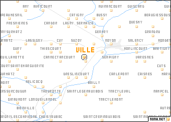
Ville (Picardie, France)Ville is a town in the Picardie region of France. An overview map of the region around Ville is displayed below.
regional and 3d topo map of Ville, France ::
Ville airports ::
The nearest airport is CSF - Creil, located 45.4 km south west of Ville.
Other airports nearby include BVA - Beauvais Tille (61.6 km west), CDG - Paris Charles De Gaulle (66.5 km south west), LBG - Paris Le Bourget (74.4 km south west), POX - Pontoise Cormeilles En Vexin (83.1 km south west), Nearby towns ::
Chiry-Ourscamp (0.0km north) //
Passel (0.0km north) //
Pimprez (3.7km south) //
Dreslincourt (3.9km south) //
Pont-lʼÉvêque (3.0km north east) //
Vauchelles (3.9km north) //
Suzoy (3.9km north) //
Porquéricourt (3.9km north) //
Ribécourt (4.4km south west) //
Sempigny (3.6km east) //
Cannectancourt (3.6km west) //
Bailly (5.7km south) //
Évricourt (4.1km north west) //
Noyon (5.2km north east) //
Cuy (5.2km north west) //
Genvry (6.1km north east) //
Saint-Léger-aux-Bois (7.4km south) //
Sermaize (7.4km north) //
Thiescourt (5.2km west) //
Beaurains-lès-Noyon (7.5km north) //
Cambronne-lès-Ribécourt (6.6km south west) //
Carlepont (6.1km south east) //
Dives (6.1km north west) //
Lagny (7.8km north) //
Montmacq (8.2km south west) //
Tracy-le-Val (8.8km south east) //
Thourotte (8.8km south west) //
Crisolles (8.8km north east) //
Candor (8.8km north west) //
[all distances 'as the bird flies' and approximate] 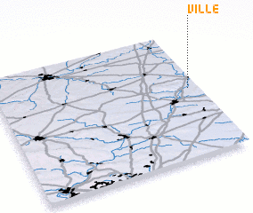 Places with similar names to Ville, France ::
Disclaimer :: Information on this page comes without warranty of any kind |
||
|
Where is Ville? Elevation and coordinates ::
Latitude (lat): 49°33'0"N Longitude (lon): 2°57'0"E
Elevation (approx.): 83m (map arrows pan, magnifying glasses zoom) |
||
|
Visiting Ville? Hotel/Accommodation ::
Book a hotel in Ville Travel Guide ::
Buy a travel guide for France rental cars ::
car rental offers GPS waypoint ::
download a GPX waypoint (PoI) of Ville for your GPS receiver
|
||