|
search place name
|
||
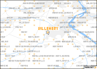
Ville Héry (Bretagne, France)Ville Héry is a town in the Bretagne region of France. An overview map of the region around Ville Héry is displayed below.
regional and 3d topo map of Ville Héry, France ::
Ville Héry airports ::
The nearest airport is ORY - Paris Orly, located 8.9 km north of Ville Héry.
Other airports nearby include TNF - Toussous-le-noble Toussus Le Noble (19.2 km north west), LBG - Paris Le Bourget (36.7 km north), CDG - Paris Charles De Gaulle (43.8 km north east), POX - Pontoise Cormeilles En Vexin (53.6 km north), Nearby towns ::
Villiers-sur-Orge (1.2km west) //
Villemoisson-sur-Orge (1.9km north) //
Épinay-sur-Orge (2.2km north east) //
Sainte-Geneviève-des-Bois (2.2km south east) //
Villetaneuse (2.2km south east) //
LʼAunay (2.2km south west) //
Saint-Michel-sur-Orge (2.2km south west) //
Le Plessis-Pâté (3.7km south) //
Brétigny-sur-Orge (3.7km south) //
Savigny-sur-Orge (3.1km north east) //
Grand Vaux (3.1km north east) //
Morsang-sur-Orge (3.1km north east) //
Longpont-sur-Orge (3.1km south west) //
Guipereux (3.1km south west) //
Ballainvilliers (3.1km north west) //
Liers (4.4km south east) //
Cherchefeuilles (4.4km north east) //
La Ville-du-Bois (3.7km west) //
Morangis (5.7km north) //
Linas (4.1km south west) //
Montlhéry (4.1km south west) //
Fleury-Mérogis (4.1km south east) //
Chilly-Mazarin (5.7km north) //
Longjumeau (5.7km north) //
Montbran (6.1km south east) //
Saulx-les-Chartreux (5.2km north west) //
Grigny (4.9km east) //
Viry-Châtillon (5.2km east) //
Champlan (6.7km north west) //
[all distances 'as the bird flies' and approximate] 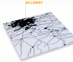 Places with similar names to Ville Héry, France ::
Disclaimer :: Information on this page comes without warranty of any kind |
||
|
Where is Ville Héry? Elevation and coordinates ::
Latitude (lat): 48°39'0"N Longitude (lon): 2°19'0"E
Elevation (approx.): 77m (map arrows pan, magnifying glasses zoom) |
||
|
Visiting Ville Héry? Hotel/Accommodation ::
Book a hotel in Ville Héry Travel Guide ::
Buy a travel guide for France rental cars ::
car rental offers GPS waypoint ::
download a GPX waypoint (PoI) of Ville Héry for your GPS receiver
|
||